Island Lake (Manitoba)
| Island Lake | |
|---|---|
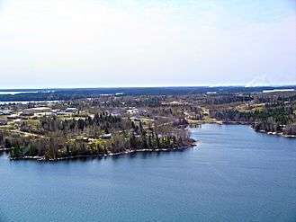
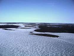 St. Theresa Point on Island Lake | |
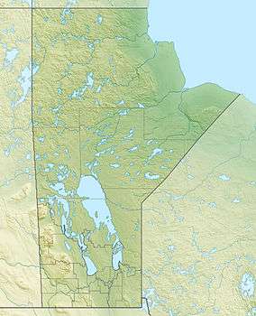 Island Lake Location in Manitoba | |
| Location |
Division No. 22, Northeastern Manitoba |
| Coordinates | 53°47′N 94°25′W / 53.783°N 94.417°WCoordinates: 53°47′N 94°25′W / 53.783°N 94.417°W |
| Primary outflows | Island Lake River |
| Catchment area | 20,000 km2 (7,700 sq mi) |
| Basin countries | Canada |
| Max. length | 85 km (53 mi) |
| Surface area | 1,223 km2 (472 sq mi) |
| Average depth | 20.1 m (66 ft) |
| Max. depth | 59.4 m (195 ft) |
| Residence time | 7.76 years |
| Shore length1 | 745 km (463 mi) |
| Surface elevation | 227 m (745 ft) |
| Settlements | Garden Hill, Island Lake, St. Theresa Point, Wasagamack |
| References | [1] |
| 1 Shore length is not a well-defined measure. | |
Island Lake is a lake in northeastern Manitoba in Canada, near the Ontario border. The lake covers a total area of 1,223 square kilometres (472 sq mi), making it the 6th largest lake in the province. The lake is in the Hayes River drainage basin. The Island Lake River flows north from the northwest section of the lake into Gods Lake via Goose Lake and Beaver Lake. Gods Lake drains north through Gods River into the Hayes River.[2][3][4][5]
A monument at the east end of the lake is a key point in the demarcation of the northeast-southwest boundary between Ontario and Manitoba.[6]
Settlements
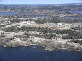
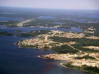
Located on the lake are the First Nations communities of Wasagamack, St. Theresa Point and Garden Hill and the northern settlement of Island Lake which in 2011 had a combined population of 7,120.
Wasagamack had a population of 1,411 in the Canada Census of 2011 and St. Theresa Point had 2,871. Both are located on the western side of the lake. About 18 km (11 miles) east across the bay are Garden Hill with a population of 2,776 and nearby Island Lake with 62 residents. The northern settlement of Island Lake is located on several islands.[3][5][7][8]
Gallery
|
Climate
| Climate data for Island Lake | |||||||||||||
|---|---|---|---|---|---|---|---|---|---|---|---|---|---|
| Month | Jan | Feb | Mar | Apr | May | Jun | Jul | Aug | Sep | Oct | Nov | Dec | Year |
| Record high °C (°F) | 5.9 (42.6) |
7.5 (45.5) |
16.2 (61.2) |
29.2 (84.6) |
32.2 (90) |
37.3 (99.1) |
35 (95) |
32.5 (90.5) |
30.4 (86.7) |
21.7 (71.1) |
15 (59) |
4.4 (39.9) |
37.3 (99.1) |
| Average high °C (°F) | −17.7 (0.1) |
−12.4 (9.7) |
−3.8 (25.2) |
5.6 (42.1) |
13.7 (56.7) |
19.5 (67.1) |
22.5 (72.5) |
21.1 (70) |
13.5 (56.3) |
5.7 (42.3) |
−4.9 (23.2) |
−14.8 (5.4) |
4 (39) |
| Daily mean °C (°F) | −22.9 (−9.2) |
−18.6 (−1.5) |
−10.8 (12.6) |
−0.8 (30.6) |
7.7 (45.9) |
14 (57) |
17.5 (63.5) |
16.4 (61.5) |
9.5 (49.1) |
2.6 (36.7) |
−8.3 (17.1) |
−19.4 (−2.9) |
−1.1 (30) |
| Average low °C (°F) | −28.1 (−18.6) |
−24.8 (−12.6) |
−17.8 (0) |
−7.1 (19.2) |
1.5 (34.7) |
8.4 (47.1) |
12.5 (54.5) |
11.6 (52.9) |
5.5 (41.9) |
−0.6 (30.9) |
−11.6 (11.1) |
−23.9 (−11) |
−6.2 (20.8) |
| Record low °C (°F) | −45 (−49) |
−43.3 (−45.9) |
−42.2 (−44) |
−28.9 (−20) |
−16.6 (2.1) |
−1.9 (28.6) |
2.2 (36) |
2.2 (36) |
−4.4 (24.1) |
−13.4 (7.9) |
−34.8 (−30.6) |
−43.3 (−45.9) |
−45 (−49) |
| Average precipitation mm (inches) | 20.1 (0.791) |
18.9 (0.744) |
24 (0.94) |
26.2 (1.031) |
42.8 (1.685) |
69.1 (2.72) |
89.4 (3.52) |
77.4 (3.047) |
61.8 (2.433) |
55.8 (2.197) |
36.3 (1.429) |
24.4 (0.961) |
546.2 (21.504) |
| Source: Environment Canada[9] | |||||||||||||
See also
References
- ↑ "World Lake Database (Island Lake)". Archived from the original on February 10, 2015. Retrieved January 13, 2015.
- ↑ Atlas of Canada – Lakes Archived April 10, 2007, at the Wayback Machine.
- 1 2 "Google Maps Distance Calculator". Retrieved 2015-01-07.
- ↑ "Natural Resources Canada-Canadian Geographical Names (Island Lake)". Retrieved 2015-01-07.
- 1 2 "Atlas of Canada Toporama". Retrieved 2015-01-07.
- ↑ "An Act to amend The Manitoba Boundaries Extension Act, 1912, and The Ontario Boundaries Extension Act (Can., 1950)". Ontario: Revised Statutes. Retrieved 26 March 2017.
- ↑ "Canada Census 2011". Retrieved 2014-01-14.
- ↑ "Corrections and updates: Population and dwelling count amendments, 2011 Census". Statistics Canada. 14 February 2013. Retrieved 2014-01-14.
- ↑ Environment Canada – Canadian Climate Normals 1971–2000—Canadian Climate Normals 1971–2000, accessed April 22, 2011
| Provinces |
|
|---|---|
| Territories | |
| |