Isla de Cedros Airport
| Isla de Cedros Airport Aeropuerto Nacional de Isla de Cedros | |||||||||||
|---|---|---|---|---|---|---|---|---|---|---|---|
| Summary | |||||||||||
| Airport type | Public | ||||||||||
| Operator | N/A | ||||||||||
| Location | Cedros Island, Baja California, Mexico | ||||||||||
| Elevation AMSL | 98 ft / 30 m | ||||||||||
| Coordinates | 28°02′15″N 115°11′22″W / 28.03750°N 115.18944°WCoordinates: 28°02′15″N 115°11′22″W / 28.03750°N 115.18944°W | ||||||||||
| Map | |||||||||||
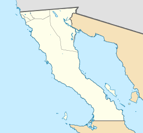 MMCD MMCD | |||||||||||
| Runways | |||||||||||
| |||||||||||
| Statistics (2016) | |||||||||||
| |||||||||||
|
Source: Dirección General de Aeronáutica Civil | |||||||||||
Isla de Cedros Airport (ICAO: MMCD) is a small airfield located on Cedros Island—Isla de Cedros, in southwestern Baja California state, Mexico.
It is 6 miles (9.7 km) south of the town of Cedros, the largest town on the island. Cedros Island is the largest Mexican island in the Pacific Ocean.
Service
The Isla de Cedros Airport handles aviation for towns on the island, including:
- Cedros
- El Morro
- San Agustín
- La Colorada
Airlines
| Airlines | Destinations |
|---|---|
| Aéreo Servicio Guerrero | Ensenada, Guerrero Negro |
| Aeroservicios California Pacífico | Ensenada |
| Calafia Airlines | Ciudad Obregón, Guaymas, Guerrero Negro, Hermosillo |
External links
- Airport information for MM10 at World Aero Data. Data current as of October 2006.
- MMCD at Fallingrain.
- MMCD at Elite Jets.
- MMCD photo at Our Airports.
This article is issued from
Wikipedia.
The text is licensed under Creative Commons - Attribution - Sharealike.
Additional terms may apply for the media files.