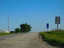
Iowa Highway 202
| ||||
|---|---|---|---|---|
|
Iowa 202 highlighted in red | ||||
| Route information | ||||
| Maintained by Iowa DOT | ||||
| Length | 10.461 mi[1] (16.835 km) | |||
| Existed | 1969[2][3] – present | |||
| Major junctions | ||||
| South end |
| |||
| North end |
| |||
| Location | ||||
| Counties | ||||
| Highway system | ||||
| ||||

Iowa Highway 202 (Iowa 202) is a short state highway in southern Iowa. The route begins at the Missouri state line, where it continues as Missouri Route 202, and ends at Iowa Highway 2 north of Moulton.
Route description
Iowa Highway 202 begins in Fabius Township, in Davis County, at the Missouri state line just north of Coatsville, Missouri. It continues in Missouri as Route 202. For its first 8 miles (13 km), it runs parallel to a former line of the Norfolk & Western railroad.[4] Because of its proximity to the abandoned rail line, Iowa 202 follows an unusual path; heading northeast, turning north, and then turning northwest into Appanoose County. It continues to the northwest for 5 miles (8.0 km) before going through an ess curve which points Iowa 202 to the north towards Moulton. North of Moulton, Iowa 202 continues due north for 3 miles (4.8 km), ending at Iowa Highway 2 in Washington Township.[1]
History
Iowa Highway 202 was designated in the 1969 Iowa highway renumbering, having previously been designated Iowa Highway 142.[2][3] No changes to the route have occurred since its designation.
Major intersections
| County | Location | mi[1] | km | Destinations | Notes |
|---|---|---|---|---|---|
| Davis | Fabius Township | 0.000 | 0.000 | ||
| Appanoose | Washington Township | 10.461 | 16.835 | ||
| 1.000 mi = 1.609 km; 1.000 km = 0.621 mi | |||||
References
- 1 2 3 "2009 Volume of Traffic on the Primary Road System of Iowa" (PDF). Iowa Department of Transportation. January 1, 2009. Retrieved January 21, 2011.
- 1 2 Iowa State Highway Map (PDF) (Map). Iowa State Highway Commission. 1968. Retrieved June 6, 2010.
- 1 2 Iowa State Highway Map (PDF) (Map). Iowa State Highway Commission. 1969. Retrieved June 6, 2010.
- ↑ Iowa State Highway Map (PDF) (Map). Iowa Department of Transportation. 1987. Retrieved June 6, 2010.