Invergordon, Victoria
| Invergordon Victoria | |||||||||||||||
|---|---|---|---|---|---|---|---|---|---|---|---|---|---|---|---|
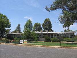 Invergordon Primary School | |||||||||||||||
 Invergordon | |||||||||||||||
| Coordinates | 36°11′S 145°38′E / 36.183°S 145.633°ECoordinates: 36°11′S 145°38′E / 36.183°S 145.633°E | ||||||||||||||
| Population | 610 (2016 census)[1] | ||||||||||||||
| Postcode(s) | 3636 | ||||||||||||||
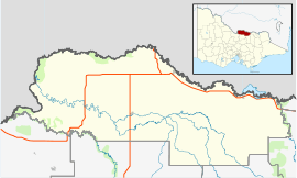
| Location |
| ||||||||||||||
| LGA(s) | Shire of Moira | ||||||||||||||
| State electorate(s) | |||||||||||||||
| Federal Division(s) | Murray | ||||||||||||||
| |||||||||||||||
| |||||||||||||||
Invergordon is a town in northern Victoria, Australia.
The town is located 31 km from Numurkah (33 min drive) and 37 km from Shepparton (41 min drive). Invergordon football club folded in 1987 due to population decline in the district.
At the 2011 census, Invergordon and the surrounding area had a population of 647.[1]
The Post Office opened on 1 February 1882 as Drumanure, was renamed Invergordon in 1885, Invergordon North in 1966 and closed in 1970. An Invergordon South Post Office opened in 1927 and closed in 1953. Invergodon is dominantly a farming area.[2]
References
- 1 2 Australian Bureau of Statistics (31 October 2012). "Invergordon (State Suburb)". 2011 Census QuickStats. Retrieved 3 December 2014.

- ↑ Premier Postal History, Post Office List, retrieved 2008-04-11
| Wikimedia Commons has media related to Invergordon, Victoria. |
This article is issued from
Wikipedia.
The text is licensed under Creative Commons - Attribution - Sharealike.
Additional terms may apply for the media files.