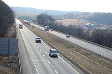
Interstate 70 in Pennsylvania
| |||||||
|---|---|---|---|---|---|---|---|
|
I-70 highlighted in red | |||||||
| Route information | |||||||
| Maintained by PennDOT and PTC | |||||||
| Length | 167.92 mi[1] (270.24 km) | ||||||
| Major junctions | |||||||
| West end |
| ||||||
|
| |||||||
| East end |
| ||||||
| Location | |||||||
| Counties | Washington, Westmoreland, Somerset, Bedford, Fulton | ||||||
| Highway system | |||||||
| |||||||

In the U.S. state of Pennsylvania, Interstate 70 (I-70) runs east–west across the southwest part of the state serving the southern fringe of the Pittsburgh metropolitan area. About half of the route is concurrent with Interstate 76 on the Pennsylvania Turnpike. This is the oldest segment of I-70 in Pennsylvania, having been completed in 1940, and is only one of two segments of I-70 that are tolled, with the other being the Kansas Turnpike. I-70 is one of only a few Interstate Highways to have a traffic signal—in this case, with U.S. Route 30 (US 30) in Breezewood, where it leaves the Turnpike and heads toward Maryland.[2]
Route description

Two segments of I-70 in Pennsylvania are not designed to modern Interstate standards: a 37-mile segment from Washington to New Stanton, and the aforementioned half-mile signalized segment in Breezewood.
For 37 miles between the eastern end of its concurrency with I-79 in Washington and the western end of its concurrency with the Pennsylvania Turnpike in New Stanton, I-70 has several dated design features. The median narrows to the point that there are no shoulders between the median barrier and the passing lanes on both sides. On- and off-ramps at many of the interchanges are substandard in both length and geometry, which requires vehicles to decelerate in the travel lanes before entering the off-ramps, and also necessitates the use of stop signs on the on-ramps instead of yield signs. Several overpasses do not meet minimum clearance requirements, which has resulted in damage to, and from, overheight trucks. Total reconstruction efforts are ongoing that will upgrade most of this segment of I-70 and its interchanges to modern Interstate standards, and various projects are scheduled through the early 2020s.
I-70 crosses the Monongahela River on the Speers-Belle Vernon Bridge and the Youghiogheny River on the Smithton High Level Bridge. In New Stanton, I-70 exits the main highway alignment to merge with the Pennsylvania Turnpike (I-76). The main alignment itself continues as a very short spur with no route number, then picks up U.S. 119 at an interchange with PA 66.
For 86 miles from New Stanton to Breezewood, I-70 shares a concurrency with I-76 along the Pennsylvania Turnpike. I-70 passes through a wind farm in Somerset County, and close to the 9/11 Flight 93 National Memorial in Shanksville. It then intersects I-99 in Bedford County before reaching the eastern end of its concurrency with the Turnpike in Breezewood.
In Breezewood, I-70 exits the Pennsylvania Turnpike and begins a half-mile wrong-way concurrency with U.S. 30. This is the other segment of the highway in Pennsylvania that is not designed to Interstate standards since it lacks grade separation and access control. I-70 then takes a north/south alignment between Breezewood and the Maryland state line, with the eastern terminus of I-68 less than a mile past the state line near Hancock. U.S. 522 also forms a four-mile concurrency with I-70 between Warfordsburg (Pa.) and Hancock (Md.).
History
| |
|---|---|
| Location | Warfordsburg–Breezewood |
| Existed | 1928–1964 |
| |
|---|---|
| Location | Washington–New Stanton |
| Existed | 1957–1963 |
By 1947, present Interstate 70 across Pennsylvania was included in the planned Interstate Highway System. The route from West Virginia split at Washington, with one branch heading northeast to meet the Pennsylvania Turnpike near Pittsburgh and the other heading east, bypassing Pittsburgh to the south (via a planned bypass of Pennsylvania Route 71) to the New Stanton interchange. The piece south from the Breezewood interchange into Maryland was also in the network.[3] The route between US 30 in Breezewood and US 522 in Warfordsburg was originally known as Pennsylvania Route 126. In 1957, preliminary numbers were assigned; the longer route via Pittsburgh (now Interstate 79 and Interstate 376) became the main line of I-70, while the southern bypass (now I-70) became Interstate 70S.[4] The section of present-day I-70 between PA 519 near Washington and New Stanton was built as a four-lane divided highway known as the "Express Highway"; this road was assigned the temporary PA 71 Alternate designation in 1957 and would be designated as I-70S following the completion of additional connecting roads in the Interstate Highway System.[5][6] On July 15, 1960, I-70 was designated onto the Penn-Lincoln Parkway.[7] A southern extension of Interstate 79 (which had previously only run from Erie south to Pittsburgh) to Charleston, West Virginia in 1963 resulted in changes to I-70. On February 26, 1964, as part of the formation of Interstate 76 (east of downtown Pittsburgh), AASHTO approved a rerouting of I-70 along I-70S. The former I-70 became I-79 from Washington to downtown Pittsburgh and I-76 to and along the Turnpike to New Stanton.[8] This brought the routing of I-70 to its present form.
Future
In 2011, PennDOT began preliminary work for a total reconstruction of I-70 between the West Virginia state line and New Stanton. Approximately $500 million will be spent on this 58-mile segment of highway in order to improve it to modern Interstate standards, half of which will be spent redesigning eight interchanges. Other planned improvements include six overpass replacements, a new roadbed, a wider median, electronic ITS signage, and widening the I-70/I-79 concurrency in Washington to six lanes.[9]
Two noteworthy interchange projects will occur in conjunction with the I-70/I-79 widening. Underway is a reconfiguration of the east/south split between I-70 and I-79, which will eliminate the one-lane, low-speed loop ramp from I-79 northbound to I-70 westbound, replacing it with a two-lane, high-speed flyover ramp.[10] Preliminary design work has also been completed for a redesigned interchange between I-70/I-79 and Murtland Avenue (U.S. 19), and involves replacing the existing substandard cloverleaf in favor of the first diverging diamond interchange in Pennsylvania.[11]
Exit list
| County | Location[12] | mi[13] | km | Old exit [14] | New exit [14] | Destinations | Notes |
|---|---|---|---|---|---|---|---|
| Washington | Donegal Township | 0.000 | 0.000 | – | – | Continuation into West Virginia | |
| 0.776 | 1.249 | 1 | 1 | West Alexander | |||
| 5.648 | 9.090 | 2 | 6 | ||||
| Buffalo Township | 10.964 | 17.645 | 3 | 11 | |||
| North Franklin–Canton township line | 14.940 | 24.044 | 4 | 15 | |||
| Canton Township | 16.027 | 25.793 | 5 | 16 | Jessop Place | ||
| Washington | 16.451 | 26.475 | 6 | 17 | |||
| South Strabane Township | 17.546 | 28.238 | – | 18 | Western end of I-79 overlap; exit 38 southbound | ||
| 18.597 | 29.929 | 7 | 19 | Diverging diamond interchange | |||
| 18.945 | 30.489 | 8 | 20 | ||||
| 21.083 | 33.930 | – | 21 | Eastern end of I-79 overlap; exit 34 northbound; also signed for Waynesburg | |||
| Somerset Township | 24.643 | 39.659 | 9 | 25 | |||
| 27.503 | 44.262 | 10 | 27 | Dunningsville | |||
| 30.592 | 49.233 | 11 | 31 | Kammerer | |||
| Somerset Township–Bentleyville line | 32.421 | 52.177 | 12A | 32A | No eastbound entrance | ||
| Bentleyville–Fallowfield Township line | 32.780 | 52.754 | 12B | 32B | |||
| Fallowfield Township | 35.201 | 56.651 | 13 | 35 | |||
| 36.396 | 58.574 | 14 | 36 | Lover | Westbound exit and eastbound entrance | ||
| 37.555– 37.571 | 60.439– 60.465 | 15A | 37A | Brownsville posted on supplemental signage | |||
| 15B | 37B | ||||||
| Twilight–Speers line | 39.877 | 64.176 | 16 | 39 | Speers | ||
| Speers | 40.248 | 64.773 | 17 | 40 | |||
| Monongahela River | 40.697 | 65.495 | Belle Vernon Bridge | ||||
| Westmoreland | Rostraver Township | 40.776 | 65.623 | 18 | 41 | ||
| North Belle Vernon | 41.528 | 66.833 | 19 | 42 | North Belle Vernon | ||
| Rostraver Township | 42.083 | 67.726 | 19A | 42A | Monessen | Westbound exit only | |
| 42.742 | 68.787 | 20 | 43 | Signed as exits 43A (south) and 43B (north) westbound | |||
| 44.216 | 71.159 | 21 | 44 | Arnold City | |||
| 46.478 | 74.799 | 22A | 46A | ||||
| 22B | 46B | ||||||
| South Huntingdon Township | 48.957 | 78.789 | 23 | 49 | Smithton | ||
| 51.257 | 82.490 | 24A | 51A | ||||
| 24B | 51B | ||||||
| 53.203 | 85.622 | 25 | 53 | Yukon | |||
| Sewickley Township | 53.923 | 86.781 | 25A | 54 | Madison | ||
| New Stanton | 56.978 | 91.697 | 26A & 26B | 57 | New Stanton | Rebuilt interchange combining former exits 57B (Hunker) and 57A (New Stanton) | |
| 57.564 | 92.640 | – | – | I-70 exits itself to toll plaza eastbound; Delmont not signed eastbound | |||
| Western end of toll road | |||||||
| – | – | Western end of I-76/Penna. Tpk. overlap; I-70 exits turnpike via exit 75 westbound; New Stanton Interchange | |||||
| Donegal | 9 | 91 | Donegal Interchange | ||||
| Somerset | 10 | 110 | Somerset Interchange | ||||
| Stonycreek–Allegheny township line | Allegheny Mountain Tunnel | ||||||
| Bedford | Bedford Township | 11 | 146 | I-99/US 220 exit 1; Bedford Interchange | |||
| East Providence Township | – | – | Eastern end of I-76/Penna. Tpk. overlap; I-70 exits turnpike via exit 161 eastbound; Breezewood Interchange | ||||
| East end of toll road | |||||||
| 146.706 | 236.100 | Western end of non-freeway section | |||||
| – | – | Eastern end of US 30 overlap; McConnellsburg signed westbound, Chambersburg and Gettysburg signed eastbound | |||||
| 147.000 | 236.574 | – | – | Western end of US 30 overlap | |||
| Eastern end of non-freeway section | |||||||
| 148.465 | 238.931 | 29 | 149 | South Breezewood | No westbound entrance | ||
| Fulton | Brush Creek Township | 150.948 | 242.927 | 30 | 151 | ||
| 155.510 | 250.269 | 31 | 156 | ||||
| Union Township | 163.007 | 262.334 | 32 | 163 | |||
| Bethel Township | 167.724 | 269.926 | 33 | 168 | Western end of US 522 overlap | ||
| 170.281 | 274.041 | – | – | Continuation into Maryland | |||
1.000 mi = 1.609 km; 1.000 km = 0.621 mi
| |||||||
See also


References
Route map:
- ↑ "Route Log - Main Routes of the Eisenhower National System Of Interstate and Defense Highways - Table 1". Federal Highway Administration. Retrieved 4 October 2014.
- ↑ Roig-Franzia, Manuel (November 22, 2001). "The Town That Stops Traffic: Travelers Encounter Way Station as Way of Life in Breezewood". Washington Post.
- ↑ National System of Interstate Highways, August 2, 1947
- ↑ Official Route Numbering for the National System of Interstate and Defense Highways, August 14, 1957
- ↑ "'Express Highway' Designated As Alternate Route 71 By PDH". The Daily Republican. Monongahela, PA. March 11, 1959. p. 1. Retrieved August 19, 2015 – via Newspapers.com.

- ↑ "Gets Temporary Route Designation". The Daily Courier. Connellsville, PA. March 12, 1959. p. 15. Retrieved August 19, 2015 – via Newspapers.com.
- ↑ "Designations Of Highways Are Changed". The Evening Standard. Uniontown, PA. July 16, 1960. p. 7. Retrieved August 28, 2015 – via Newspapers.com.
- ↑ Ask the Rambler, Was I-76 Numbered to Honor Philadelphia for Independence Day, 1776?
- ↑ "I-70 Projects". I-70 Projects. Retrieved 2013-01-29.
- ↑ (PDF) http://www.i-70projects.com/docs/projectinfo_website.pdf. Retrieved 2013-01-29. Missing or empty
|title=(help) - ↑ "PennDOT District 12-0 - Media Release". Dot.state.pa.us. 2012-01-11. Retrieved 2013-01-29.
- ↑ "Video Log". Pennsylvania Department of Transportation. Retrieved June 29, 2016.
- ↑ Bureau of Maintenance and Operations (January 2016). Roadway Management System Straight Line Diagrams (Report) (2015 ed.). Pennsylvania Department of Transportation. Retrieved June 29, 2016.
- 1 2 "Pennsylvania Exit Numbering" (PDF). Pennsylvania Department of Transportation. Retrieved October 2, 2007.
| Previous state: West Virginia |
Pennsylvania | Next state: Maryland |