Interstate 670 (Kansas–Missouri)
| |||||||||
|---|---|---|---|---|---|---|---|---|---|
| Jay B. Dillingham Freeway | |||||||||
|
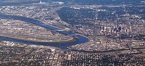
I-670 highlighted in red | |||||||||
| Route information | |||||||||
| Length | 2.81 mi[1] (4.52 km) | ||||||||
| Existed | 1968 – present | ||||||||
| Major junctions | |||||||||
| West end |
| ||||||||
|
| |||||||||
| East end |
| ||||||||
| Location | |||||||||
| States | Kansas, Missouri | ||||||||
| Counties | KS: Wyandotte; MO: Jackson | ||||||||
| Highway system | |||||||||
| |||||||||

Interstate 670 (abbreviated I-670) is a 2.81 mile (4.52 km) connector highway between I-70 in Kansas City, Kansas and I-70 in Kansas City, Missouri. The highway provides a more direct route through downtown Kansas City than the older mainline I-70, and avoids the sharp turn (and reduced speed limit) of the latter at the west end of the Intercity Viaduct. I-670 is also designated Alternate Interstate 70, one of the few interstates to be designated as an alternate. Interstate 670 also makes up the south side of Kansas City's downtown freeway loop, where it passes under the southern half of Bartle Hall Convention Center.
The road crosses the Kansas River and the West Bottoms, the former location of the Kansas City Stockyards, on the I-670 Viaduct. The leg of the highway west of I-35 has Kansas Department of Transportation signs proclaiming it the Jay B. Dillingham Freeway[2] although maps list it as the Jay B. Dillingham Memorial Highway.[3] Dillingham was a former president of the Stockyards.
Route description
The freeway begins with ramps from I-70 meeting to form I-670 just before a bridge over the Kansas River, which is located just south of the confluence of the Kansas and Missouri rivers. I-70 at that point comprises U.S. Route 24, U.S. Route 40, and U.S. Route 169. The freeway then crosses the Kansas–Missouri state line and enters Kansas City, Missouri. The road then interchanges with Interstate 35 before meeting its terminus at I-70. The freeway continues as I-70.[4]
History

The freeway was not part of the original planned freeways around Kansas City in 1955.[5] The section east of the I-35 interchange was built first and finished in 1968.[6][7] The western portion was not planned until 1971, and was not finished until several years later.[8][9] By 1987, the freeway was extended slightly westward in the downtown Kansas area,[10][11] but was not fully extended to I-70 until 1991, when it was fully opened.[12][13]
A portion of the highway near downtown Kansas City, Missouri was closed on May 20, 1997, in order to film the music video for the U2 song "Last Night on Earth". The band reimbursed the Kansas City Police Department for all traffic control and security costs. A permit issued by the Missouri Highway and Transportation Department (the predecessor to MoDOT) stated the closure "will enhance and promote the notoriety of...Kansas City's skyline." Mike Right, vice-president of public affairs for the American Automobile Association Auto Club of Missouri, told the Kansas City Star "I can't believe the stupidity of it. They're going to close down an interstate highway that serves downtown Kansas City for a...music video? I've never heard of such a thing."[14]
Exit list
| State | County | Location | mi | km | Exit | Destinations | Notes |
|---|---|---|---|---|---|---|---|
| Kansas | Wyandotte | Kansas City | 0.00 | 0.00 | I-70 exit 421B | ||
| 1A | Central Avenue | Westbound exit and eastbound entrance | |||||
| Kansas River bridge | |||||||
0.000 | 0.000 | Kansas–Missouri state line | |||||
| Missouri | Jackson | Kansas City | 1B | Genesee Street / Wyoming Street – Kemper Arena | |||
| 2T | I-35 exit 2U | ||||||
| Westbound exit and eastbound entrance; I-35 exit 2U | |||||||
| 2S | Broadway | Westbound exit and eastbound entrance | |||||
| 2R | Central Street – Downtown | Eastbound exit only | |||||
| 2Q | Truman Road / McGee Street | Westbound exit and eastbound entrance | |||||
| 2.81 | 4.52 | 2P | 13th Street – Downtown Kansas City | Westbound exit only | |||
| 2N | Eastbound exit and westbound entrance; I-70 exit 2L | ||||||
| 2M | Eastbound exit and westbound entrance | ||||||
| 3A | The Paseo | Eastbound exit only | |||||
| I-70 exit 2L | |||||||
| 1.000 mi = 1.609 km; 1.000 km = 0.621 mi | |||||||
See also


References
- ↑ Staff (October 31, 2001). "Table 2: Auxiliary Routes of the Dwight D. Eisenhower National System Of Interstate and Defense Highways as of October 31, 2002". Route Log and Finder List. Federal Highway Administration. Retrieved May 28, 2012.
- ↑ Kansas State Legislature. "Statute 68-1035: Designation of part of interstate highway 670 as the Dillingham freeway". Kansas Statutes. Retrieved May 28, 2012.
- ↑ Google (June 8, 2009). "Interstate 670 (Kansas–Missouri)" (Map). Google Maps. Google. Retrieved June 8, 2009.
- ↑ Microsoft; Nokia (January 26, 2011). "I-670" (Map). Bing Maps. Microsoft. Retrieved January 26, 2011.
- ↑ General Location of National System of Interstate Highways Including All Additional Routes at Urban Areas (Map). Bureau of Public Roads. September 1955. Kansas City, Missouri inset. Retrieved May 28, 2012.
- ↑ Missouri State Highway Map (PDF) (Map). Missouri Department of Transportation. 1968. Retrieved February 27, 2011.
- ↑ Kansas State Highway Map (Map). Kansas Department of Transportation. 1968. Retrieved February 27, 2011.
- ↑ Missouri State Highway Map (PDF) (Map). Missouri Department of Transportation. 1971. Retrieved February 27, 2011.
- ↑ Kansas State Highway Map (Map). Kansas Department of Transportation. 1971. Retrieved February 27, 2011.
- ↑ Missouri State Highway Map (PDF) (Map) (1987–88 ed.). Missouri Department of Transportation. 1987. Retrieved February 26, 2011.
- ↑ Kansas State Highway Map (Map). Kansas Department of Transportation. 1987. Retrieved February 27, 2011.
- ↑ Missouri State Highway Map (PDF) (Map) (1991–92 ed.). Missouri Department of Transportation. 1991. Retrieved February 27, 2011.
- ↑ Kansas State Highway Map (Map) (1991–92 ed.). Kansas Department of Transportation. 1991. Retrieved February 27, 2011.
- ↑ Heider, Timothy (May 20, 1997). "Filming of Music Video Will Shut Down I-670 Downtown for Several Hours Tuesday". The Kansas City Star. Reproduced by @U2. Accessed November 23, 2013.
External links
Route map:
- Kansas Highway Maps: Current, Historic, KDOT
- Interstate 670 Kansas/Missouri, Interstate-Guide.com