Indian Old Fields, Kentucky
| Indian Old Fields | |
|---|---|
| Unincorporated community | |
 Indian Old Fields Location within the state of Kentucky  Indian Old Fields Indian Old Fields (the US) | |
| Coordinates: 37°56′45″N 84°00′00″W / 37.94583°N 84.00000°WCoordinates: 37°56′45″N 84°00′00″W / 37.94583°N 84.00000°W | |
| Country | United States |
| State | Kentucky |
| County | Clark |
| Elevation | 768 ft (234 m) |
| Time zone | UTC-6 (Central (CST)) |
| • Summer (DST) | UTC-5 (CST) |
| GNIS feature ID | [1] |
Indian Old Fields was an unincorporated community located in Clark County, Kentucky, United States.
The community takes its name from the Indian old field present when white settlers arrived. They discovered the Native American settlement of Eskippakaithiki, believed to be the last Indian village in Kentucky.[2] It was also named Indian Old Corn Field. It was established by Peter Chartier, the leader of a band of Shawnee, sometime in 1745.[3]
Further reading
- Beckner, Lucien (October 1932). "Eskippakithiki, The Last Indian Town in Kentucky". Filson Club History Quarterly. 6 (4). Retrieved 2011-11-29.
References
- ↑ "Indian Old Fields, Kentucky". Geographic Names Information System. United States Geological Survey.
- ↑ Federal Writers' Project (1996). The WPA Guide to Kentucky. University Press of Kentucky. p. 242. Retrieved 24 November 2013.
- ↑ Charles Augustus Hanna, The Wilderness Trail: Or, The Ventures and Adventures of the Pennsylvania Traders on the Allegheny Path, Volume 1 The Wilderness Trail: Or, The Ventures and Adventures of the Pennsylvania Traders on the Allegheny Path, Putnam's sons, 1911
Municipalities and communities of Clark County, Kentucky, United States | ||
|---|---|---|
| City | 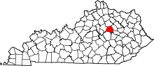 | |
| Unincorporated communities | ||
This article is issued from
Wikipedia.
The text is licensed under Creative Commons - Attribution - Sharealike.
Additional terms may apply for the media files.