Indian Hills, New Mexico
| Indian Hills, New Mexico | |
|---|---|
| Census-designated place | |
 Indian Hills | |
| Coordinates: 34°58′59″N 106°08′23″W / 34.98306°N 106.13972°WCoordinates: 34°58′59″N 106°08′23″W / 34.98306°N 106.13972°W | |
| Country | United States |
| State | New Mexico |
| County | Torrance |
| Area[1] | |
| • Total | 5.714 sq mi (14.80 km2) |
| • Land | 5.714 sq mi (14.80 km2) |
| • Water | 0 sq mi (0 km2) |
| Elevation | 6,460 ft (1,970 m) |
| Population (2010)[1] | |
| • Total | 892 |
| • Density | 160/sq mi (60/km2) |
| Time zone | UTC-7 (Mountain (MST)) |
| • Summer (DST) | UTC-6 (MDT) |
| Area code(s) | 505 |
| GNIS feature ID | 2584089[2] |
Indian Hills is an unincorporated community and census-designated place in Torrance County, New Mexico, United States. Its population was 892 as of the 2010 census.[1]
Geography
Indian Hills is located at 34°58′59″N 106°08′23″W / 34.9831760°N 106.1397513°W.[2] According to the U.S. Census Bureau, the community has an area of 5.714 square miles (14.80 km2), all of it land.[1]
References
Municipalities and communities of Torrance County, New Mexico, United States | ||
|---|---|---|
| City | 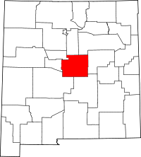 | |
| Towns | ||
| Village | ||
| CDPs | ||
| Other unincorporated communities | ||
| Footnotes | ‡This populated place also has portions in an adjacent county or counties | |
This article is issued from
Wikipedia.
The text is licensed under Creative Commons - Attribution - Sharealike.
Additional terms may apply for the media files.