Cedarvale, New Mexico
| Cedarvale, New Mexico | |
|---|---|
| Unincorporated community | |
 Cedarvale, New Mexico | |
| Coordinates: 34°22′14″N 105°42′07″W / 34.37056°N 105.70194°WCoordinates: 34°22′14″N 105°42′07″W / 34.37056°N 105.70194°W | |
| Country | United States |
| State | New Mexico |
| County | Torrance |
| Elevation | 6,384 ft (1,946 m) |
| Time zone | UTC-7 (Mountain (MST)) |
| • Summer (DST) | UTC-6 (MDT) |
| ZIP code | 87009[1] |
| Area code(s) | 505 |
| GNIS feature ID | 918127[2] |
Cedarvale is an unincorporated community in Torrance County, New Mexico, United States.[2] Cedarvale is located on New Mexico State Road 42 10.2 miles (16.4 km) northeast of Corona. Cedarvale had a post office until it closed on May 15, 1990; it still has its own ZIP code, 87009.[1][3]
References
- 1 2 United States Postal Service (2012). "USPS - Look Up a ZIP Code". Retrieved 2012-02-15.
- 1 2 "Cedarvale". Geographic Names Information System. United States Geological Survey.
- ↑ "Postmaster Finder - Post Offices by ZIP Code". United States Postal Service. Retrieved August 20, 2013.
Municipalities and communities of Torrance County, New Mexico, United States | ||
|---|---|---|
| City | 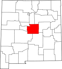 | |
| Towns | ||
| Village | ||
| CDPs | ||
| Other unincorporated communities | ||
| Footnotes | ‡This populated place also has portions in an adjacent county or counties | |
This article is issued from
Wikipedia.
The text is licensed under Creative Commons - Attribution - Sharealike.
Additional terms may apply for the media files.