India Hook, South Carolina
| India Hook, South Carolina | |
|---|---|
| CDP | |
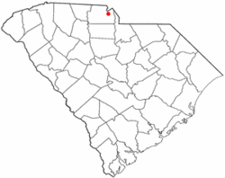 Location of India Hook, South Carolina | |
| Coordinates: 35°0′52″N 81°2′40″W / 35.01444°N 81.04444°WCoordinates: 35°0′52″N 81°2′40″W / 35.01444°N 81.04444°W | |
| Country | United States |
| State | South Carolina |
| County | York |
| Area | |
| • Total | 3.7 sq mi (9.5 km2) |
| • Land | 2.8 sq mi (7.2 km2) |
| • Water | 0.9 sq mi (2.3 km2) |
| Elevation | 663 ft (202 m) |
| Population (2010) | |
| • Total | 2,051 |
| • Density | 582.0/sq mi (224.7/km2) |
| Time zone | UTC-5 (Eastern (EST)) |
| • Summer (DST) | UTC-4 (EDT) |
| FIPS code | 45-35635[1] |
| GNIS feature ID | 1246112[2] |
India Hook is a census-designated place (CDP) in York County, South Carolina, United States. Majority of India Hook is annexed into the city of Rock Hill, but as of 2010 India Hook is still considered to be a CDP. It is one of the three communities located on Lake Wylie.
The population was 2,051 at the 2010 census.
Geography
India Hook is located at 35°0′52″N 81°2′40″W / 35.01444°N 81.04444°W (35.014366, -81.044490).[3]
According to the United States Census Bureau, the CDP has a total area of 3.7 square miles (9.6 km2), of which 2.8 square miles (7.3 km2) is land and 0.9 square miles (2.3 km2) (24.52%) is water.
Demographics
As of the census[1] of 2000, there were 1,614 people, 641 households, and 496 families residing in the CDP. The population density was 582.0 people per square mile (225.0/km²). There were 702 housing units at an average density of 253.2/sq mi (97.8/km²). The racial makeup of the CDP was 96.59% White, 1.05% African American, 0.50% Native American, 0.81% Asian, and 1.05% from two or more races. Hispanic or Latino of any race were 0.25% of the population.
There were 641 households out of which 32.8% had children under the age of 18 living with them, 65.7% were married couples living together, 8.3% had a female householder with no husband present, and 22.5% were non-families. 20.0% of all households were made up of individuals and 4.2% had someone living alone who was 65 years of age or older. The average household size was 2.52 and the average family size was 2.88.
In the CDP, the population was spread out with 23.0% under the age of 18, 5.9% from 18 to 24, 30.0% from 25 to 44, 29.1% from 45 to 64, and 11.8% who were 65 years of age or older. The median age was 40 years. For every 100 females, there were 95.6 males. For every 100 females age 18 and over, there were 98.7 males.
The median income for a household in the CDP was $54,266, and the median income for a family was $62,566. Males had a median income of $37,214 versus $24,646 for females. The per capita income for the CDP was $24,693. About 6.2% of families and 7.8% of the population were below the poverty line, including 10.6% of those under age 18 and 3.7% of those age 65 or over.
See also
References
- 1 2 "American FactFinder". United States Census Bureau. Archived from the original on September 11, 2013. Retrieved 2008-01-31.
- ↑ "US Board on Geographic Names". United States Geological Survey. 2007-10-25. Retrieved 2008-01-31.
- ↑ "US Gazetteer files: 2010, 2000, and 1990". United States Census Bureau. 2011-02-12. Retrieved 2011-04-23.
Municipalities and communities of York County, South Carolina, United States | ||
|---|---|---|
| Cities | 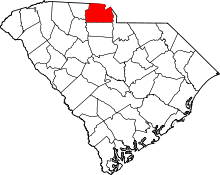 | |
| Towns | ||
| CDPs | ||
| Other unincorporated communities | ||
| Indian reservation | ||
| Footnotes | ‡This populated place also has portions in an adjacent county or counties | |