Illington
| Illington | |
|---|---|
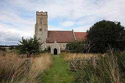 Saint Andrew Parish Church, Illington | |
 Illington Illington shown within Norfolk | |
| Population | 366 (parish, 2001 census) |
| OS grid reference | TL9489 |
| • London | 92.3 miles (148.5 km) |
| Civil parish |
|
| District | |
| Shire county | |
| Region | |
| Country | England |
| Sovereign state | United Kingdom |
| Post town | THETFORD |
| Postcode district | IP24 |
| Dialling code | 01953 |
| Police | Norfolk |
| Fire | Norfolk |
| Ambulance | East of England |
| EU Parliament | East of England |
Illington is a village and former civil parish in the English county of Norfolk.[1] The population is now included in the civil parish of Wretham.[2] The village is 6.2 miles north east of Thetford, 24 miles west south west of Norwich and 92.3 miles north east of London.[3] The nearest railway station is at Thetford for the Breckland Line which runs between Cambridge and Norwich. The nearest airport is Norwich International Airport.
History
Illington has an entry in the Domesday Book of 1085.[4] In the great book Illington is recorded by the name ‘’Illinketune’’. The main landholder is William de Warenne
References
- ↑ OS Explorer Map 236 - King’s Lynn, Downham Market & Swaffham. ISBN 978-0-319-46408-3.
- ↑ "Illington AP/CP through time: Census tables with data for the Parish-level Unit". A Vision of Britain through Time. GB Historical GIS / University of Portsmouth. Retrieved 29 June 2017.
- ↑ County A to Z Atlas, Street & Road maps Norfolk, ISBN 978-1-84348-614-5
- ↑ The Domesday Book, Englands Heritage, Then and Now, Editor: Thomas Hinde,Norfolk page 191, Illington, ISBN 1-85833-440-3
External links
| Wikimedia Commons has media related to Illington. |
- Map sources for Illington
This article is issued from
Wikipedia.
The text is licensed under Creative Commons - Attribution - Sharealike.
Additional terms may apply for the media files.