Ikwuano
| Ikwuano | |
|---|---|
| LGA and town | |
| Motto(s): onye ahala nwanneya | |
 Ikwuano | |
| Coordinates: 5°26′N 7°34′E / 5.433°N 7.567°ECoordinates: 5°26′N 7°34′E / 5.433°N 7.567°E | |
| Country |
|
| State | Abia State |
| Area | |
| • Total | 108 sq mi (281 km2) |
| Population (2006) | |
| • Total | 137,993 |
| Time zone | UTC+1 (WAT) |
Ikwuano is a Local Government Area of Abia State, Nigeria. Its headquarters is in Isiala Oboro.
It has an area of 281 km² and a population of 137,993 at the 2006 census. It is made up of about 52 villages and communities and is bounded by Ini LGA of Akwa Ibom State by the West and Umuahia North. Ikwuano Local Government Area can be referred to as the food basket of Abia State basically because of rich agricultural produce it is endowed with. Ikwuano as the name implies is derived from the coming together of four (4) Related brothers namely Oboro, Ibere Ariam-Ushaka and Oloko, Ikwu (Relations/Relatives) and Ano (Four 4) Meaning four relations. Ikwuano LGA was among the new local government areas that were created on the 27th of August 1991 when the General Ibrahim Babangida's Administration created Abia State from the old Imo State it was carved out of the old Ikwuano-Umuahia Local Government Area. It one of the five LGAs that make up Abia Central Senatorial District.The first executive chairman is Chief Chima Onyemachi.
The postal code of the area is 440.[1]
References
- ↑ "Post Offices- with map of LGA". NIPOST. Archived from the original on 2009-10-07. Retrieved 2009-10-20.
Capital: Umuahia | ||
| Local Government Areas | 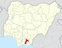 | |
Ikwuano houses the famous Michael Okpara University of Agriculture Umudike, The National Crop Research Institute as well as the prestigious Government Collage Umuahia. It is known for her Agricultural activities(Farming) with much concentration on Palm Oil/Carnal, Cocoa Cassava, Yam, Broom, Basket., etc.