Ikersuaq, East Greenland
| Ikersuaq | |
|---|---|
| Ikertivaq | |
 Map of Greenland section | |
 Ikersuaq Location in Greenland | |
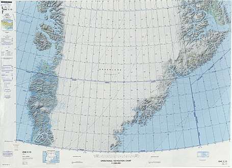
| Location | SE Greenland |
| Coordinates | 66°38′N 34°28′W / 66.633°N 34.467°WCoordinates: 66°38′N 34°28′W / 66.633°N 34.467°W |
| Ocean/sea sources | North Atlantic Ocean |
| Basin countries | Greenland |
| Max. length | 25 km (16 mi) |
| Max. width | 3 km (1.9 mi) |
| References | [1] |
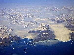
Ikersuaq (old spelling Ikerssuak), also known as Ikertivaq, is a fjord in Sermersooq municipality, southeastern Greenland.[1]
Tundra climate prevails in the region of the fjord, the average annual temperature in the area being -10° C. The warmest month is July when the average temperature rises to 0° C and the coldest is January with -18° C.[2]
Geography
Ikersuaq is a fjord of the King Christian IX Land coast. It extends in a roughly north/south direction for about 25 km. To the south the fjord opens into the North Atlantic Ocean near Tasiilap Karra (Cape Gustav Holm).[3] The fjord has two main branches: Eastern Tasiisaq (Ostre Tasiisaq), extending 13 km north on the western side of Cape Gustav Holm, and Western Tasiisaq (Vester Tasiisaq) extending 5 km to the SW 10 km from the mouth on the western shore of the fjord.[4] The Northern K.J.V. Steenstrup Glacier has its terminus just south of the promontory at the mouth of the fjord.[1]
See also
References
- 1 2 3 GoogleEarth
- ↑ "NASA Earth Observations Data Set Index". NASA. Retrieved 8 June 2016.
- ↑ "Ikersuaq". Mapcarta. Retrieved 8 June 2016.
- ↑ Prostar Sailing Directions 2005 Greenland and Iceland Enroute, p. 108