Humnoke, Arkansas
| Humnoke, Arkansas | |
|---|---|
| City | |
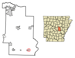 Location of Humnoke in Lonoke County, Arkansas. | |
 Humnoke, Arkansas Location in the United States | |
| Coordinates: 34°32′32″N 91°45′32″W / 34.54222°N 91.75889°WCoordinates: 34°32′32″N 91°45′32″W / 34.54222°N 91.75889°W | |
| Country | United States |
| State | Arkansas |
| County | Lonoke |
| Area[1] | |
| • Total | 0.31 sq mi (0.81 km2) |
| • Land | 0.31 sq mi (0.81 km2) |
| • Water | 0.00 sq mi (0.00 km2) |
| Elevation | 197 ft (60 m) |
| Population (2010) | |
| • Total | 284 |
| • Estimate (2017)[2] | 278 |
| • Density | 885.35/sq mi (341.83/km2) |
| Time zone | UTC-6 (Central (CST)) |
| • Summer (DST) | UTC-5 (CDT) |
| ZIP code | 72072 |
| Area code(s) | 501 |
| FIPS code | 05-33820 |
| GNIS feature ID | 0050405 |
| Website | www.humnoke.com |
Humnoke is a city in Lonoke County, Arkansas, United States. The population was 280 at the 2000 census. It is part of the Little Rock–North Little Rock–Conway Metropolitan Statistical Area.
Geography
Humnoke is located at 34°32′32″N 91°45′32″W / 34.54222°N 91.75889°W (34.542238, -91.758971).[3]
According to the United States Census Bureau, the city has a total area of 0.3 square miles (0.78 km2), all land.
Demographics
| Historical population | |||
|---|---|---|---|
| Census | Pop. | %± | |
| 1950 | 263 | — | |
| 1960 | 319 | 21.3% | |
| 1970 | 398 | 24.8% | |
| 1980 | 442 | 11.1% | |
| 1990 | 311 | −29.6% | |
| 2000 | 280 | −10.0% | |
| 2010 | 284 | 1.4% | |
| Est. 2017 | 278 | [2] | −2.1% |
| U.S. Decennial Census[4] | |||
As of the census[5] of 2000, there were 280 people, 111 households, and 77 families residing in the city. The population density was 826.4 people per square mile (318.0/km²). There were 130 housing units at an average density of 383.7/sq mi (147.6/km²). The racial makeup of the city was 85.71% White, 10.36% Black or African American, 0.36% Asian, 1.79% from other races, and 1.79% from two or more races. 2.86% of the population were Hispanic or Latino of any race.
There were 111 households out of which 36.0% had children under the age of 18 living with them, 54.1% were married couples living together, 9.9% had a female householder with no husband present, and 30.6% were non-families. 27.0% of all households were made up of individuals and 14.4% had someone living alone who was 65 years of age or older. The average household size was 2.52 and the average family size was 3.10.
In the city, the population was spread out with 28.2% under the age of 18, 6.1% from 18 to 24, 32.1% from 25 to 44, 20.0% from 45 to 64, and 13.6% who were 65 years of age or older. The median age was 33 years. For every 100 females, there were 93.1 males. For every 100 females age 18 and over, there were 95.1 males.
The median income for a household in the city was $21,528, and the median income for a family was $28,125. Males had a median income of $27,500 versus $15,750 for females. The per capita income for the city was $15,194. About 15.2% of families and 20.3% of the population were below the poverty line, including 23.5% of those under the age of eighteen and 27.8% of those sixty five or over.
Education
Since the consolidation of the Humnoke School District on July 1, 1998,[6] public education for elementary and secondary school students is provided by the Carlisle School District, which leads to graduation from Carlisle High School.
References
- ↑ "2017 U.S. Gazetteer Files". United States Census Bureau. Retrieved Aug 22, 2018.
- 1 2 "Population and Housing Unit Estimates". Retrieved March 24, 2018.
- ↑ "US Gazetteer files: 2010, 2000, and 1990". United States Census Bureau. 2011-02-12. Retrieved 2011-04-23.
- ↑ "Census of Population and Housing". Census.gov. Archived from the original on May 12, 2015. Retrieved June 4, 2015.
- ↑ "American FactFinder". United States Census Bureau. Archived from the original on September 11, 2013. Retrieved 2008-01-31.
- ↑ "ConsolidationAnnex_from_1983.xls." Arkansas Department of Education. Retrieved on October 13, 2017.
Municipalities and communities of Lonoke County, Arkansas, United States | ||
|---|---|---|
| Cities | 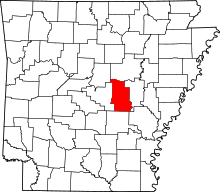 | |
| Towns | ||
| CDP | ||
| Townships |
| |
| Unincorporated communities | ||
| Footnotes | ‡This populated place also has portions in an adjacent county or counties | |