Huckleberry Botanic Regional Preserve
| Huckleberry Botanic Regional Preserve | |
|---|---|
| Type | Botanical preserve |
| Location | San Francisco Bay Area, California |
| Nearest city | Oakland, California |
| Area | 241 acres (0.98 km2) |
| Operated by | East Bay Regional Park District |
Huckleberry Botanic Regional Preserve is a 241 acres (0.98 km2) regional park and nature reserve in the Berkeley Hills, in the eastern East Bay (San Francisco Bay Area) region of the San Francisco Bay Area of California. It is within Alameda and Contra Costa Counties.[1] It is a park within the East Bay Regional Parks District system.[1] The Preserve is named after the California Huckleberry (Vaccinium ovatum) which grows abundantly within its habitat.[1]
Geography
The Huckleberry Botanic Regional Preserve is on the crest of the Oakland Hills, located above Oakland and Orinda. It represents a relic plant association found only in certain areas along the coastal climate region of California, where specific soil and climatic conditions still exist.[1] It is a very diverse botanical area for native plants of the mixed evergreen forest and montane chaparral and woodlands ecoregions and plant communities. Trails connect the preserve with Robert Sibley Volcanic Preserve on the north, and Redwood Regional Park on the south.[2]
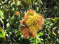
The Huckleberry Trail is a 1.7 miles (2.7 km) self-guided nature path that loops through the Preserve.[1] Besides the California Huckleberry, other plants include the Golden chinquapin (Chrysolepis chrysophylla), and California Bay (Umbellularia californica) and Coast live oak (Quercus agrifolia) woodlands.[1]
Visitation
The park is open year-round, between 5:00 AM and 10:00 PM daily, unless otherwise posted. No dogs are permitted in the park because of the sensitive plant habitat. There are no reservable campgrounds or picnic sites. Parking is free.[1]
See also
References
- 1 2 3 4 5 6 7 EBRPD-huckleberry "Huckleberry Botanic Regional Preserve." East Bay Regional Parks District Accessed November 1, 2011
- ↑ "Huckleberry Botanic Regional Preserve." Oakland Wiki. Accessed September 1, 2017.
External links
| Wikimedia Commons has media related to Huckleberry Botanic Regional Preserve. |
Coordinates: 37°50′42″N 122°11′24″W / 37.845°N 122.19°W