Del Valle Regional Park
| Del Valle Regional Park | |
|---|---|
.jpg) Del Valle Regional Park and Lake | |
| Location | Alameda County, California |
| Nearest city | Livermore, California |
| Area | 4,316 acres |
| Created | 1968 |
| Operated by | East Bay Regional Parks District |
| Status | Open |
Del Valle Regional Park is a part of the East Bay Regional Park District (EBRPD) in an unincorporated region of Alameda County, California, 10 miles (16 km) south of the city of Livermore.[1] The park covers 4,316 acres (~17.47 km2., ~6.74 sq. mi.).[1]
Geography
General Description
The park largely surrounds Lake Del Valle, an artificial reservoir made in 1968 by damming Arroyo Valle, a small river. The lake provides a source of recreation for visitors including swimming, fishing, and boating. There are lifeguards present at designated swimming areas.
The park also offers 28 miles (~45.1 km) of hiking, horseback, and bicycle trails, in addition to 150 camping sites. It is the eastern gate for the Ohlone Wilderness Trail, which leads to Sunol and Mission Peak Regional Parks.[1]
Trails
The park, like many East Bay Regional Parks, has numerous trails. One trail, the East Shore Trail, leads from the Arroyo Road staging area to a ridge above Del Valle, and then follows the lake for several miles toward the boat launch. The Sailor Camp Trail leads to the Ohlone Wilderness Trail, and an unnamed trail leads to Mendenhall Road. Most of the trails climb hills around the lake; most, however, stay between 500 to 1,500 feet (150 to 460 m) in elevation.[2]
Access to the park
By car
The park can be approached from Del Valle Park Road (via Mines Road) or Arroyo Road, where the parking meter is often broken. Del Valle Road connects to the southern end of the park, while Arroyo Road connects to the northern staging area.
Mines Road can be reached from Tesla Road (J2) and the California State Route 130. Arroyo Road can be reached from Concannon Boulevard and Wetmore Road.
By foot
You can reach the Arroyo staging area along a narrow footpath which connects to Sycamore Grove Park and the general LARPD (Livermore Area Recreation and Park District) trail network.[3]

History
Early Years
Construction crews began work on the lake in 1966.[4] The construction of Del Valle Reservoir was finished in 1968.[5] Del Valle Regional Park was opened to the public in 1970,[6] 36 years after the EBRPD was founded in 1934.[7]
California Drought in 2010s
In the mid-2010s, a severe drought struck the California region, including the East Bay.[8] This situation caused 12 million trees in California to die, and resulted in the East Bay Regional Park District writing an article to help with the drought.[9]
Flooding in the 2016-2017 winter
Shortly after the California drought in the 2010s, Del Valle Regional Park suffered widespread damage from the unusually heavy rains and La Niña that struck the East Bay in early 2017. Much of the damage was around Lake Del Valle, where runoff overflowed five times into beaches, campgrounds and picnic areas. Some of the trails were washed out and needed to be rebuilt. The park was closed for nearly three months, before reopening on April 15, 2017. EBRPD estimated the cost to repair this park alone at $1.8 billion, and said the cost would rise further if the rains continued.[10]
With another La Niña scheduled for the 2017-2018 winter, it is quite possible that repairs will have to be done after the upcoming winter as well.[11]
Gallery
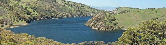 Lake Del Valle reservoir, within Del Valle Regional Park in the Diablo Range, Alameda County, San Francisco Bay Area, California.
29 March 2009, Photo by John K.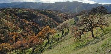 Del Valle Regional Park - Eagle Crest Trail
January 1, 2010
Photo by Miguel Viera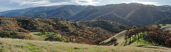 Del Valle Regional Park - Eagle Crest Trail
January 1, 2010
Photo by Miguel Viera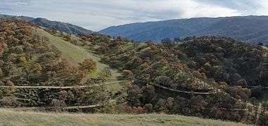 Del Valle Regional Park - Ridgeline Trail
January 1, 2010
Photo by Miguel Viera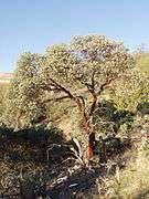 Del Valle Regional Park - Cedar Mountain
Arctostaphylos glauca — bigberry manzanita
Photo by Joey Malone - 2009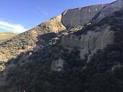 Cliffs at the northern end of Del Valle Regional Park
See also
References
- 1 2 3 Del Valle Regional Park profile, East Bay Regional Park District, retrieved September 1, 2007
- ↑ "Del Valle Regional Park". www.ebparks.org. Retrieved 2017-12-05.
- ↑ "LAPRD Trail Network" (PDF).
- ↑ "Current History Detectives Article". www.bunnweb.org. Retrieved 2017-12-05.
- ↑ "Del Valle Reservoir". www.zone7water.com. Retrieved 2017-12-05.
- ↑ "Del Valle Map Text Side" (PDF).
- ↑ "Celebrating Eighty Years of Regional Parks in 2014". www.ebparks.org. Retrieved 2017-12-05.
- ↑ "California drought: Sour water — a new normal in the East Bay?". SFGate. Retrieved 2017-12-05.
- ↑ "The Drought and Our Parks". www.ebparks.org. Retrieved 2017-12-05.
- ↑ Cuff, Denis. "Storms hit parks hard." Bay Area News Group. April 15, 2017. Accessed April 15, 2017.
- ↑ "La Niña Declared; Cooldown Nipping the Warmest Autumn on Record in Northeast U.S. by Bob Henson | Category 6". Weather Underground. Retrieved 2017-12-05.
External links
| Wikivoyage has a travel guide for Del Valle Regional Park. |
Coordinates: 37°36′02″N 121°42′39″W / 37.600564°N 121.710835°W
| Wikimedia Commons has media related to Del Valle Regional Park. |