Huancaray District
| Huancaray Wankaray | |
|---|---|
| District | |
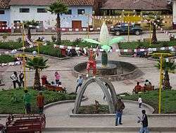 Square of Huancaray | |
| Country |
|
| Region | Apurímac |
| Province | Andahuaylas |
| Capital | Huancaray |
| Government | |
| • Mayor | Macedonio Martin Mallcco Matute |
| Area | |
| • Total | 112.2 km2 (43.3 sq mi) |
| Elevation | 2,902 m (9,521 ft) |
| Population (2005 census) | |
| • Total | 4,775 |
| • Density | 43/km2 (110/sq mi) |
| Time zone | UTC-5 (PET) |
| UBIGEO | 030205 |
Huancaray (from Quechua Wankaray,[1] meaning "to gobble") is one of the nineteen districts of the Andahuaylas Province in Peru.[2]
Geography
One of the highest peaks of the district is Wamanripa at approximately 4,200 m (13,800 ft). Other mountains are listed below:[3]
- Aqu Urqu
- Arpa Kancha
- Chipaw
- Chiri Yaku
- Ch'iqchi
- Hatun Wasi
- Qillqa
- Waman Tiyana
- Wamp'u
Ethnic groups
The people in the district are mainly indigenous citizens of Quechua descent. Quechua is the language which the majority of the population (89.23%) learnt to speak in childhood, 10.23% of the residents started speaking using the Spanish language (2007 Peru Census).[4]
References
- ↑ Asociación Paz y Esperanza, Delfín Farfán Villa, Roberto Farfán Villa, Willaykusqayki, Ministry of Education, Lima, Peru, 2014
- ↑ (in Spanish) Instituto Nacional de Estadística e Informática. Banco de Información Digital Archived 2008-04-23 at the Wayback Machine.. Retrieved April 4, 2008.
- ↑ escale.minedu.gob.pe/ UGEL map Andahuaylas Province (Apurímac Region)
- ↑ inei.gob.pe Archived 2013-01-27 at the Wayback Machine. INEI, Peru, Censos Nacionales 2007, Frequencias: Preguntas de Población
Coordinates: 13°46′15″S 73°32′12″W / 13.77083°S 73.53667°W
This article is issued from
Wikipedia.
The text is licensed under Creative Commons - Attribution - Sharealike.
Additional terms may apply for the media files.