Haquira District
| Haquira Jaqhira | |
|---|---|
| District | |
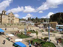 Main square in Haquira | |
| Country |
|
| Region | Apurímac |
| Province | Cotabambas |
| Founded | January 2, 1857 |
| Capital | Haquira |
| Government | |
| • Mayor | Rogelio Chahua Pacco |
| Area | |
| • Total | 475.46 km2 (183.58 sq mi) |
| Elevation | 3,671 m (12,044 ft) |
| Population (2005 census) | |
| • Total | 10,593 |
| • Density | 22/km2 (58/sq mi) |
| Time zone | UTC-5 (PET) |
| UBIGEO | 030504 |
Haquira District is one of the six districts of the Cotabambas Province in Peru.[1]
Geography
One of the highest peaks of the district is Huch'uy Miyu Kancha at approximately 4,600 m (15,100 ft). Other mountains are listed below:[2]
- Anka Wachana
- Chitayuq
- Inti Tiyana
- Kuntur Marka
- Laram Kancha
- Llawi Rumiyuq
- Minas Pata
- Parqa Kancha
- Parqa Urqu
- Pata Pampa
- Puka Qaqa
- Phiruru
- Qhawana Marka
- Surimana
- Taya Sirk'a
- Urpiyuq Phaqcha
- Waqra Q'asa
- Waraquyuq
- Winchus
- Yana Qutu
- Yana Waylla
Ethnic groups
The people in the district are mainly indigenous citizens of Quechua descent. Quechua is the language which the majority of the population (91.26%) learnt to speak in childhood, 8.52% of the residents started speaking using the Spanish language (2007 Peru Census).[3]
See also
References
- ↑ (in Spanish) Instituto Nacional de Estadística e Informática. Banco de Información Digital Archived 2008-04-23 at the Wayback Machine.. Retrieved April 7, 2008.
- ↑ escale.minedu.gob.pe/ UGEL map Cotabambas Province (Apurímac Region)
- ↑ inei.gob.pe Archived 2013-01-27 at the Wayback Machine. INEI, Peru, Censos Nacionales 2007, Frequencias: Preguntas de Población
Coordinates: 14°13′24″S 72°11′41″W / 14.22333°S 72.19472°W
This article is issued from
Wikipedia.
The text is licensed under Creative Commons - Attribution - Sharealike.
Additional terms may apply for the media files.