Hpa-An Airport
| Hpa-An Airport ဖးအါကဘီယူၤပျီ | |||||||||||
|---|---|---|---|---|---|---|---|---|---|---|---|
| Summary | |||||||||||
| Airport type | Public | ||||||||||
| Operator | Ministry of Transport | ||||||||||
| Serves | Hpa-An | ||||||||||
| Location | Hpa-An, Myanmar | ||||||||||
| Elevation AMSL | 41 ft / 12 m | ||||||||||
| Coordinates | 16°53′38″N 097°40′30″E / 16.89389°N 97.67500°ECoordinates: 16°53′38″N 097°40′30″E / 16.89389°N 97.67500°E | ||||||||||
| Map | |||||||||||
 PAA Location of airport in Myanmar | |||||||||||
| Runways | |||||||||||
| |||||||||||
Hpa-An Airport (IATA: PAA, ICAO: VYPA) is an airport of serving Hpa-an (also spelled Pa-An),[1] a city of Karen in south-eastern Myanmar.
Facilities
The airport resides at an elevation of 41 feet (12 m) above mean sea level. It has one runway designated 03/21 with an asphalt surface measuring 4,502 by 102 feet (1,372 m × 31 m).[1]
Airlines and destinations
| AIRLINE | IMAGE | ICAO | DESTINATIONS | ROUTE | NOTES |
|---|---|---|---|---|---|
| Myanmar National Airlines | 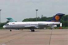 | UBA | Yangon | Domestic | Ceased |
| Myanmar National Airlines | | UBA | Mawlamyine | Domestic | Ceased |
| Myanmar National Airlines | | UBA | Hpapun | Domestic | - |
Now, it's a disused airfield.
References
- 1 2 3 Airport information for VYPA from DAFIF (effective October 2006)
- ↑ Airport information for PAA at Great Circle Mapper. Source: DAFIF (effective October 2006).
This article is issued from
Wikipedia.
The text is licensed under Creative Commons - Attribution - Sharealike.
Additional terms may apply for the media files.