Howe, Indiana
| Howe | |
|---|---|
| census-designated place | |
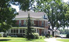 Classic farmhouse along the south side of State Road 120 on the east side of Howe. | |
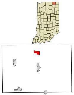 Location of Howe in LaGrange County, Indiana. | |
 Howe Location of Howe in LaGrange County, Indiana. | |
| Coordinates: 41°43′17″N 85°25′14″W / 41.72139°N 85.42056°WCoordinates: 41°43′17″N 85°25′14″W / 41.72139°N 85.42056°W | |
| Country | United States |
| State | Indiana |
| County | LaGrange |
| Township | Lima |
| Elevation | 879 ft (268 m) |
| ZIP code | 46746 |
| GNIS feature ID | 436547[1] |
Howe is a small unincorporated census-designated place in Lima Township, LaGrange County, Indiana.
History
Howe was settled in 1834. At that time, it was named Mongoquinong, a name that the Potawatomi Indians had given to the prairie in northeastern Indiana. Shortly thereafter it was renamed Lima and was, at that time, the county seat. It was later renamed Howe after John B. Howe, a local attorney.[2]
The Howe Military School, the town's most famous attraction, was founded in 1884.
_Indiana_1876.PNG)
Local Places on the National Register
Sites in Howe on the National Register of Historic Places are:
- John Badlam Howe Mansion which is also known as the Howe Military School Rectory.
- Lima Township School
- St. James Memorial Chapel
- Star Milling and Electric Company Historic District
- Samuel P. Williams House
Geography
Howe is located at 41°43′17″N 85°25′14″W / 41.72139°N 85.42056°W at the intersection of State Road 120 and State Road 9. It is approximately three miles south of the IN US 80/90 toll road and five miles north of LaGrange.
Demographics
| Historical population | |||
|---|---|---|---|
| Census | Pop. | %± | |
| U.S. Decennial Census[3] | |||
References
- ↑ "Howe, Indiana". Geographic Names Information System. United States Geological Survey. Retrieved 2009-10-17.
- ↑ Baker, Ronald L. (October 1995). From Needmore to Prosperity: Hoosier Place Names in Folklore and History. Indiana University Press. p. 172. ISBN 978-0-253-32866-3.
...renamed for lawyer John B. Howe...
- ↑ "Census of Population and Housing". Census.gov. Retrieved June 4, 2016.
Municipalities and communities of LaGrange County, Indiana, United States | ||
|---|---|---|
| Towns | ||
| Townships | ||
| CDP | ||
| Other unincorporated communities |
| |
| Footnotes | ‡This populated place also has portions in an adjacent county or counties | |