Hongkou District
| Hongkou 虹口区 | |
|---|---|
| District | |
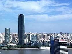 The View of The North Bund, HongKou, Shanghai | |
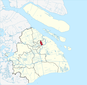 Hongkou in Shanghai | |
| Country | People's Republic of China |
| Municipality | Shanghai |
| Time zone | UTC+8 (China Standard) |
| Hongkou District | |||||||||||
| Simplified Chinese | 虹口区 | ||||||||||
|---|---|---|---|---|---|---|---|---|---|---|---|
| Traditional Chinese | 虹口區 | ||||||||||
| Postal | Hongkew | ||||||||||
| |||||||||||
![]()
It is the location of the Astor House Hotel, Broadway Mansions, Lu Xun Park, and Hongkou Football Stadium. It was once known as Shanghai's "Little Tokyo"
Hongkou is home to the Shanghai International Studies University (SISU), the Shanghai University of Finance and Economics, and the 1933 Old Millfun.
History
Formerly part of the International Concession, it was in large part reduced to rubble during the Second World war when Shanghai was occupied by the Japanese.[1] 20,000 Jewish refugees from Nazi-occupied Europe lived in an overcrowded square-mile section known to as the Shanghai Ghetto, in the Tilanqiao neighborhood of Hongkew.[2]
Subdistricts
Hongkou is responsible for the administration of the following subdistricts.
| Name | Chinese (S) | Hanyu Pinyin | Shanghainese Romanization | Population (2010)[3] | Area (km2) |
|---|---|---|---|---|---|
| Ouyang Road Subdistrict | 欧阳路街道 | Ōuyánglù Jiēdào | oe yan lu ka do | 73,328 | 1.67 |
| Quyang Road Subdistrict | 曲阳路街道 | Qūyánglù Jiēdào | chioq yan lu ka do | 102,564 | 3.05 |
| Guangzhong Road Subdistrict | 广中路街道 | Guǎngzhōnglù Jiēdào | kuaon tzon lu ka do | 122,669 | 2.89 |
| Jiaxing Road Subdistrict | 嘉兴路街道 | Jiāxìnglù Jiēdào | cia ka xin lu ka do | 125,634 | 2.63 |
| Liangcheng Xincun Subdistrict | 凉城新村街道 | Liángchéng Xīncūn Jiēdào | lian zen sin tsen ka do | 98,094 | 3.14 |
| Sichuan North Road Subdistrict | 四川北路街道 | Sìchuānběilù Jiēdào | sy tseu poq lu ka do | 87,401 | 2.33 |
| Tilanqiao Subdistrict | 提篮桥街道 | Tílán qiáo Jiēdào | tiq leh djio ka do | 113,751 | 2.36 |
| Jiangwanzhen Subdistrict | 江湾镇街道 | Jiāngwānzhèn Jiēdào | kaon ue tzen ka do | 129,035 | 4.17 |
Economy
Previously Lianhua Supermarket had its Shanghai office in the district.[4]
Schools
Russian Consulate School in Shanghai is a Russian overseas primary school operated by the Russian Ministry of Foreign Affairs, located on the grounds of the Consulate-General of Russia in Shanghai in Hongkou District.[5]
- Shanghai Beihong Senior High School
- Shanghai Beijiao Senior High School
- Shanghai Chengzhong Senior High School
- Shanghai Jiguang Senior High School
- Shanghai No.1 Normal Senior High School
- Shanghai Fuxing Senior High School
- Shanghai Hongkou Senior High School
- Shanghai Hainan middle school
Transportation
Metro
Hongkou is currently served by five metro lines operated by Shanghai Metro:
- Line 3 - Dongbaoxing Road, Hongkou Football Stadium 8 , Chifeng Road, Dabaishu, Jiangwan Town
- Line 4 - Hailun Road 10 , Linping Road
- Line 8 - Siping Road 10 , Quyang Road, Hongkou Football Stadium 3
- Line 10 - North Sichuan Road, Hailun Road 4 , Youdian Xincun, Siping Road 8
- Line 12 - International Cruise Terminal, Tilanqiao
References
- ↑ Cosentino, Francesco. SHANGHAI FROM MODERNISM TO MODERNITY (Deluxe Edition). Lulu.com. p. 51. ISBN 9781312985674. Retrieved 4 October 2016.
- ↑ James Griffiths (21 November 2013). "Shanghai's Forgotten Jewish Past". The Atlantic.
- ↑ shi, Guo wu yuan ren kou pu cha ban gong; council, Guo jia tong ji ju ren kou he jiu ye tong ji si bian = Tabulation on the 2010 population census of the people's republic of China by township / compiled by Population census office under the state; population, Department of; statistics, employment statistics national bureau of (2012). Zhongguo 2010 nian ren kou pu cha fen xiang, zhen, jie dao zi liao (Di 1 ban. ed.). Beijing Shi: Zhongguo tong ji chu ban she. ISBN 978-7-5037-6660-2.
- ↑ Lianhua 2003(?) Annual Report (Archive). Lianhua Supermarket. p. 2. "Registered Office 11th to 15th Floors 1666 Sichuan (North) Road Shanghai The PRC Place of Business in Hong Kong 26th to 27th Floors Harcourt Building 39 Gloucester Road Wanchai Hong Kong" - Traditional Chinese (Archive): "註冊辦事處 中國上海 四川北路1666號 11至15樓 香港營業地點 香港灣仔告士打道39號 夏愨大廈26至27樓"
- ↑ "Контакты" (Archive). Russian Consulate School in Shanghai. Retrieved on April 14, 2015. "Адрес: 200080, КНР, г. Шанхай ул. Хуанпу № 20. English: 200000, PRC, Shanghai, Hong Kou Qu Districs [sic], 20 Huang Pu Lu"
Further reading
- "Hongkou District". Encyclopedia of Shanghai. Shanghai Municipal Government. 2010. Archived from the original on 2013-03-02.
External links
| Wikimedia Commons has media related to Hongkou District. |

| Administrative divisions |  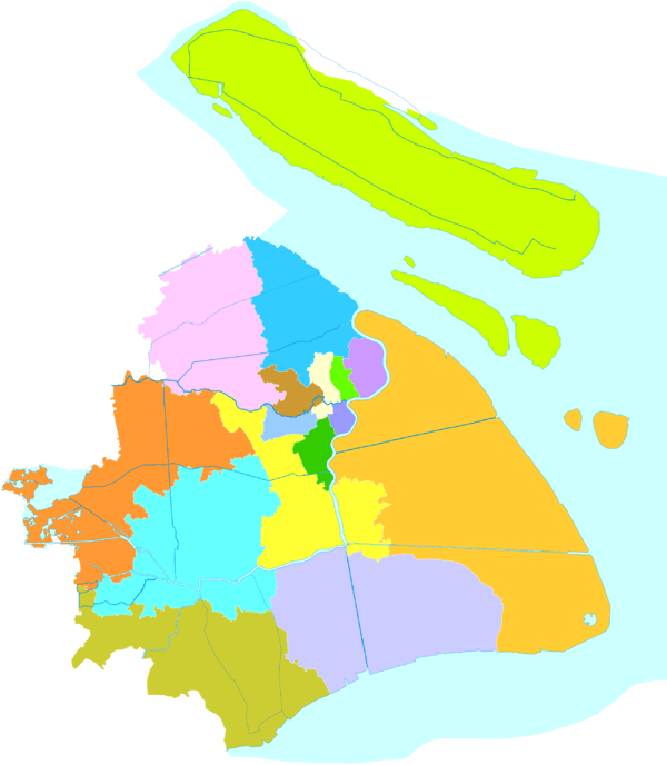 | ||||||
|---|---|---|---|---|---|---|---|
| Areas | |||||||
| Streets | |||||||
| Attractions | |||||||
| Culture and demographics | |||||||
| Hotels | |||||||
| Museums | |||||||
| Parks | |||||||
| Places of worship |
| ||||||
| Skyscrapers | |||||||
| Sports venues | |||||||
| Transport |
| ||||||
| Universities |
| ||||||
| Sports | |||||||
| |||||||