Hitterdalen
| Hitterdalen | |
|---|---|
| Village | |
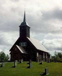 View of the chapel in the village | |
 Hitterdalen Location of the village  Hitterdalen Hitterdalen (Norway) | |
| Coordinates: 62°36′36″N 11°38′13″E / 62.6100°N 11.6369°ECoordinates: 62°36′36″N 11°38′13″E / 62.6100°N 11.6369°E | |
| Country | Norway |
| Region | Central Norway |
| County | Trøndelag |
| District | Gauldalen |
| Municipality | Røros |
| Elevation[1] | 726 m (2,382 ft) |
| Time zone | UTC+01:00 (CET) |
| • Summer (DST) | UTC+02:00 (CEST) |
| Post Code | 7374 Røros |
Hitterdalen is a village in the municipality of Røros in Trøndelag county, Norway. The village is located on the road between the town of Røros and the village of Brekken, about half way between the two places. It sits about 3 kilometres (1.9 mi) south of the lake Aursunden. Hitterdal Chapel is located in the village.
References
- ↑ "Hitterdalen, Røros (Sør-Trøndelag)". yr.no. Retrieved 2018-01-13.
This article is issued from
Wikipedia.
The text is licensed under Creative Commons - Attribution - Sharealike.
Additional terms may apply for the media files.