Hill 'n Dale, Florida
| Hill 'n Dale, Florida | |
|---|---|
| Census-designated place | |
 The faded sign that used to greet residents of and visitors to Hill 'n Dale | |
 Location in Hernando County and the state of Florida | |
| Coordinates: 28°31′26″N 82°17′38″W / 28.52389°N 82.29389°WCoordinates: 28°31′26″N 82°17′38″W / 28.52389°N 82.29389°W | |
| Country | United States |
| State | Florida |
| County | Hernando |
| Area | |
| • Total | 2.2 sq mi (5.7 km2) |
| • Land | 2.2 sq mi (5.7 km2) |
| • Water | 0 sq mi (0 km2) |
| Elevation | 108 ft (33 m) |
| Population (2010) | |
| • Total | 1,934 |
| • Density | 879/sq mi (339.5/km2) |
| Time zone | UTC-5 (Eastern (EST)) |
| • Summer (DST) | UTC-4 (EDT) |
| FIPS code | 12-30800[1] |
| GNIS feature ID | 0300931[2] |
Hill 'n Dale is a census-designated place (CDP) in Hernando County, Florida, United States. The population was 1,934 at the 2010 census.[3]
Geography
Hill 'n Dale is located in eastern Hernando County at 28°31′26″N 82°17′38″W / 28.52389°N 82.29389°W (28.523830, -82.293973), along U.S. Route 98.[4] The older part of the community is north of the highway, but the CDP was expanded for the 2010 census to include a more lightly settled area south of the highway. US 98 leads west 6 miles (10 km) to Brooksville, the county seat, and east 3.5 miles (5.6 km) to Interstate 75 and 7 miles (11 km) to Ridge Manor. Hill 'n Dale is 44 miles (71 km) north of Tampa and 56 miles (90 km) south of Ocala.
According to the United States Census Bureau, the CDP has a total area of 2.2 square miles (5.7 km2), all land.[3]
Demographics
As of the census[1] of 2000, there were 1,436 people, 463 households, and 368 families residing in the CDP. The population density was 2,823.3 people per square mile (1,087.1/km²). There were 511 housing units at an average density of 1,004.7/sq mi (386.9/km²). The racial makeup of the CDP was 70.54% White, 24.79% African American, 0.14% Native American, 0.56% Asian, 2.16% from other races, and 1.81% from two or more races. Hispanic or Latino of any race were 7.59% of the population.
There were 463 households out of which 47.3% had children under the age of 18 living with them, 49.5% were married couples living together, 23.1% had a female householder with no husband present, and 20.5% were non-families. 15.8% of all households were made up of individuals and 6.7% had someone living alone who was 65 years of age or older. The average household size was 3.10 and the average family size was 3.43.
In the CDP, the population was spread out with 36.4% under the age of 18, 9.9% from 18 to 24, 26.8% from 25 to 44, 17.4% from 45 to 64, and 9.5% who were 65 years of age or older. The median age was 28 years. For every 100 females, there were 86.7 males. For every 100 females age 18 and over, there were 72.9 males.
The median income for a household in the CDP was $31,974, and the median income for a family was $30,214. Males had a median income of $26,349 versus $22,065 for females. The per capita income for the CDP was $10,029. About 20.6% of families and 18.5% of the population were below the poverty line, including 23.1% of those under age 18 and 5.4% of those age 65 or over.
See also
References
- 1 2 "American FactFinder". United States Census Bureau. Retrieved 2008-01-31.
- ↑ "US Board on Geographic Names". United States Geological Survey. 2007-10-25. Retrieved 2008-01-31.
- 1 2 "Geographic Identifiers: 2010 Demographic Profile Data (G001): Hill 'n Dale CDP, Florida". American Factfinder. U.S. Census Bureau. Retrieved April 27, 2017.
- ↑ "US Gazetteer files: 2010, 2000, and 1990". United States Census Bureau. 2011-02-12. Retrieved 2011-04-23.
Municipalities and communities of Hernando County, Florida, United States | ||
|---|---|---|
| Cities | 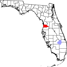 | |
| CDPs | ||
| Unincorporated community | ||