Hideaway, Texas
| Hideaway, Texas | |
|---|---|
| Town | |
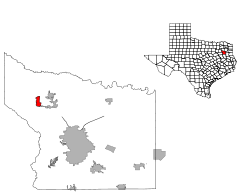 Location of Hideaway, Texas | |
| Country | United States |
| State | Texas |
| County | Smith |
| Government | |
| • President of the Board of Directors | Jean Cox |
| Area | |
| • Total | 2.4 sq mi (6 km2) |
| • Land | 2.0 sq mi (5 km2) |
| • Water | 0.4 sq mi (1 km2) |
| Population (2014) | |
| • Total | 3,194 |
| • Density | 1,300/sq mi (510/km2) |
| Time zone | UTC-6 (Central (CST)) |
| • Summer (DST) | UTC-5 (CDT) |
| Zip Code | 75771 |
Hideaway is a largely residential city and gated community in Smith County, Texas, United States. It is located directly north of Interstate 20; the main gate accessed by Exit 552 - FM 849. Hideaway is approximately 13 miles (21 km) northwest of Tyler and 79 miles (127 km) east of Dallas.[1] It had an estimated population of 3,001 in 2009.[2] The 2010 census counted 3,083 residents.
Hideaway is part of the Tyler Metropolitan Statistical Area.
History
The land that now encompasses Hideaway was originally included in the large plantation owned by Texas governor Richard B. Hubbard.[3] Later, the land was purchased by developer James Fair. In 1967, Fair planned and developed the land, naming it "Hide-A-Way Lake."[4] The community was slated to contain 1,350 acres (5.5 km2) with a total 1,944 residential lots.[3] In 2000, the community, then managed by Hideaway Homeowners, Inc. (which is the HOA) and Hideaway Lake Club, Inc. (which operates the golfing facilities) merged, forming a municipal corporation known as Hideaway Lake Club, Inc.[3]
Demographics
| Historical population | |||
|---|---|---|---|
| Census | Pop. | %± | |
| 2010 | 3,083 | — | |
| Est. 2016 | 3,127 | [5] | 1.4% |
| U.S. Decennial Census[6] | |||
Education
The Lindale Independent School District serves area students.
References
- ↑ "Hide-A-Way Lake Information"
- ↑ "Table 4: Annual Estimates of the Resident Population for Incorporated Places in Texas, Listed Alphabetically: April 1, 2000 to July 1, 2009". United States Census Bureau, Population Division. 2010-06-22. Archived from the original (CSV) on June 27, 2010. Retrieved 2010-06-24.
- 1 2 3 Hideaway, TX - Handbook of Texas Online
- ↑ "Hideaway, Texas"
- ↑ "Population and Housing Unit Estimates". Retrieved June 9, 2017.
- ↑ "Census of Population and Housing". Census.gov. Archived from the original on May 12, 2015. Retrieved June 4, 2015.
External links
- Hideaway, Texas from the Handbook of Texas Online
- Hideaway Lake Club
Municipalities and communities of Smith County, Texas, United States | ||
|---|---|---|
| Cities | 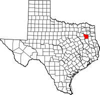 | |
| Towns | ||
| CDP | ||
| Other unincorporated communities |
| |
| Ghost towns | ||
| Footnotes | ‡This populated place also has portions in an adjacent county or counties | |
Coordinates: 32°29′26″N 95°27′27″W / 32.49056°N 95.45750°W