Heron, Montana
| Heron, Montana | |
|---|---|
| CDP | |
 Location of Heron, Montana | |
| Coordinates: 48°3′27″N 115°57′37″W / 48.05750°N 115.96028°WCoordinates: 48°3′27″N 115°57′37″W / 48.05750°N 115.96028°W | |
| Country | United States |
| State | Montana |
| County | Sanders |
| Area | |
| • Total | 3.4 sq mi (8.8 km2) |
| • Land | 3.4 sq mi (8.8 km2) |
| • Water | 0.0 sq mi (0.0 km2) |
| Elevation | 2,251 ft (686 m) |
| Population (2000) | |
| • Total | 149 |
| • Density | 43.9/sq mi (17.0/km2) |
| Time zone | UTC-7 (Mountain (MST)) |
| • Summer (DST) | UTC-6 (MDT) |
| ZIP code | 59844 |
| Area code(s) | 406 |
| FIPS code | 30-35875 |
| GNIS feature ID | 0784801 |
Heron is a census-designated place (CDP) in Sanders County, Montana, named for the village of Heron which is located within it. The population of the entire CDP was 149 at the 2000 census.
Geography
Heron is located at 48°3′27″N 115°57′37″W / 48.05750°N 115.96028°W (48.057437, -115.960373).[1]
According to the United States Census Bureau, the CDP has a total area of 3.4 square miles (8.8 km2), all land.
Climate
Heron has a continental Mediterranean climate (Dsb) that is more in common with northern Idaho and the PNW than the rest of Montana. It is one of the wettest climates in the state, with snowy winters with occasional rain and dryer, warm summers. Around 11 days per year reach 90 while 100 is a very rare occurrence. Nights are cool year round with freezes having been recorded in every month. On average, the lowest temperature each year is -12, placing it in hardiness zone 5B.
| Climate data for Heron 1981-2010, extremes 1912- | |||||||||||||
|---|---|---|---|---|---|---|---|---|---|---|---|---|---|
| Month | Jan | Feb | Mar | Apr | May | Jun | Jul | Aug | Sep | Oct | Nov | Dec | Year |
| Record high °F (°C) | 61 (16) |
59 (15) |
73 (23) |
88 (31) |
96 (36) |
100 (38) |
105 (41) |
106 (41) |
97 (36) |
87 (31) |
68 (20) |
58 (14) |
106 (41) |
| Average high °F (°C) | 33.0 (0.6) |
37.9 (3.3) |
46.8 (8.2) |
57.4 (14.1) |
66.3 (19.1) |
73.0 (22.8) |
81.3 (27.4) |
80.9 (27.2) |
70.2 (21.2) |
54.6 (12.6) |
39.7 (4.3) |
31.7 (−0.2) |
56.1 (13.4) |
| Average low °F (°C) | 22.3 (−5.4) |
22.8 (−5.1) |
27.2 (−2.7) |
32.0 (0) |
38.4 (3.6) |
44.5 (6.9) |
47.1 (8.4) |
45.8 (7.7) |
39.7 (4.3) |
33.3 (0.7) |
28.6 (−1.9) |
21.7 (−5.7) |
33.6 (0.9) |
| Record low °F (°C) | −39 (−39) |
−32 (−36) |
−22 (−30) |
−1 (−18) |
19 (−7) |
25 (−4) |
29 (−2) |
21 (−6) |
9 (−13) |
4 (−16) |
−14 (−26) |
−35 (−37) |
−39 (−39) |
| Average precipitation inches (mm) | 4.25 (108) |
2.91 (73.9) |
2.94 (74.7) |
2.36 (59.9) |
2.83 (71.9) |
2.82 (71.6) |
1.38 (35.1) |
1.07 (27.2) |
1.73 (43.9) |
2.69 (68.3) |
4.61 (117.1) |
4.15 (105.4) |
33.74 (857) |
| Average snowfall inches (cm) | 24.5 (62.2) |
12.6 (32) |
8.6 (21.8) |
1.3 (3.3) |
0.1 (0.3) |
0 (0) |
0 (0) |
0 (0) |
0 (0) |
0.3 (0.8) |
8.8 (22.4) |
24.6 (62.5) |
80.8 (205.3) |
| Average precipitation days (≥ 0.04 in) | 14.7 | 10.8 | 12.0 | 10.1 | 10.8 | 9.8 | 5.5 | 4.6 | 6.3 | 10.2 | 14.6 | 14.2 | 123.6 |
| Average snowy days (≥ 0.4 in) | 9.6 | 5.8 | 4.0 | 1.0 | 0.1 | 0 | 0 | 0 | 0 | 0.3 | 4.7 | 10.5 | 36 |
| Source: NWS NOWDATA for Heron 2NW from the NWS Missoula area | |||||||||||||
Demographics
As of the census[2] of 2000, there were 149 people, 58 households, and 41 families residing in the CDP. The population density was 43.9 people per square mile (17.0/km²). There were 63 housing units at an average density of 18.6 per square mile (7.2/km²). The racial makeup of the CDP was 94.63% White, 3.36% Native American, 0.67% Asian, and 1.34% from two or more races.
There were 58 households out of which 32.8% had children under the age of 18 living with them, 67.2% were married couples living together, 3.4% had a female householder with no husband present, and 29.3% were non-families. 29.3% of all households were made up of individuals and 12.1% had someone living alone who was 65 years of age or older. The average household size was 2.57 and the average family size was 3.20.
In the CDP, the population was spread out with 30.9% under the age of 18, 2.7% from 18 to 24, 24.8% from 25 to 44, 27.5% from 45 to 64, and 14.1% who were 65 years of age or older. The median age was 42 years. For every 100 females, there were 98.7 males. For every 100 females age 18 and over, there were 98.1 males.
The median income for a household in the CDP was $28,750, and the median income for a family was $31,875. Males had a median income of $27,500 versus $20,000 for females. The per capita income for the CDP was $14,725. There were 15.8% of families and 18.2% of the population living below the poverty line, including 4.9% of under eighteens and 8.7% of those over 64.
References
- ↑ "US Gazetteer files: 2010, 2000, and 1990". United States Census Bureau. 2011-02-12. Retrieved 2011-04-23.
- ↑ "American FactFinder". United States Census Bureau. Retrieved 2008-01-31.
Municipalities and communities of Sanders County, Montana, United States | ||
|---|---|---|
| City | 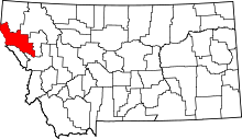 | |
| Towns | ||
| CDPs | ||
| Indian reservation | ||
| Footnotes | ‡This populated place also has portions in an adjacent county or counties | |