Munich Heimeranplatz station
Heimeranplatz | |||||||||||||||||||||||||||||||
|---|---|---|---|---|---|---|---|---|---|---|---|---|---|---|---|---|---|---|---|---|---|---|---|---|---|---|---|---|---|---|---|
 | |||||||||||||||||||||||||||||||
| Location |
Garmischer Str., Schwanthalerhöhe, Munich, Bavaria Germany | ||||||||||||||||||||||||||||||
| Coordinates | 48°8′0″N 11°32′1″E / 48.13333°N 11.53361°ECoordinates: 48°8′0″N 11°32′1″E / 48.13333°N 11.53361°E | ||||||||||||||||||||||||||||||
| Line(s) | |||||||||||||||||||||||||||||||
| Platforms |
| ||||||||||||||||||||||||||||||
| Other information | |||||||||||||||||||||||||||||||
| Station code | 4235[1] | ||||||||||||||||||||||||||||||
| DS100 code | MHP[2] | ||||||||||||||||||||||||||||||
| IBNR | 8005419 | ||||||||||||||||||||||||||||||
| Category | 4[1] | ||||||||||||||||||||||||||||||
| Website | |||||||||||||||||||||||||||||||
| History | |||||||||||||||||||||||||||||||
| Opened | 1984 | ||||||||||||||||||||||||||||||
| Services | |||||||||||||||||||||||||||||||
| |||||||||||||||||||||||||||||||
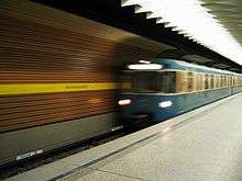
München Heimeranplatz is a railway and Munich U-Bahn interchange station. It sits on the border of two Munich boroughs, Laim and Schwanthalerhöhe. It offers transfer between S-Bahn and U-Bahn as well as local bus services and serves as a transportation hub for the Westend and eastern Laim.
The subway runs in a tunnel in a roughly east–west direction, while the S-Bahn's two platforms – a middle platform for the S 7 service and a single-side platform for the S 20 – are situated on an elevated level on an overpass on the Garmischer Straße stretch of Munich's central ring road, the Mittlerer Ring. In the northern direction, the S-Bahn tracks split, with S20 continuing west towards Pasing and S7 continuing east towards Donnersbergerbrücke. The S-Bahn station is located to the west of the subway station, necessitating a short walk alongside an elevated sidewalk.[3]
Name
The station is named after the adjacent Heimeranplatz, north-east of the station. The square, in turn, is named after Ernst Heimeran, a Munich author and publisher. The Mittlerer Ring orbital road passes under Heimeranplatz, in a stretch called the Trappentreu tunnel, Munich's first tunnel on the ring road.
Notable places nearby
- Bavariapark
- Westpark
- Theresienwiese
- Rudi-Sedlmayer-Halle/Audi Dome
References
- 1 2 "Stationspreisliste 2018" [Station price list 2018] (PDF) (in German). DB Station&Service. 5 October 2017. Retrieved 14 December 2017.
- ↑ Eisenbahnatlas Deutschland (German railway atlas) (2009/2010 ed.). Schweers + Wall. 2009. ISBN 978-3-89494-139-0.
- ↑ "Map of the station area, showing the S-Bahn and U-Bahn station, bus stops and disabled access" (PDF) (in German). MVV. Retrieved 27 March 2013.
External links
- "Description and plans of the station" (in German). BEG. Retrieved 27 March 2013.