Hay River/Merlyn Carter Airport
| Hay River/Merlyn Carter Airport | |||||||||||||||
|---|---|---|---|---|---|---|---|---|---|---|---|---|---|---|---|
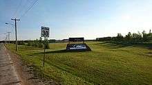 Hay River Airport sign | |||||||||||||||
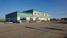 Airport terminal | |||||||||||||||
| Summary | |||||||||||||||
| Airport type | Public | ||||||||||||||
| Operator | Government of the Northwest Territories | ||||||||||||||
| Location | Hay River, Northwest Territories | ||||||||||||||
| Time zone | MST (UTC−07:00) | ||||||||||||||
| • Summer (DST) | MDT (UTC−06:00) | ||||||||||||||
| Elevation AMSL | 541 ft / 165 m | ||||||||||||||
| Coordinates | 60°50′23″N 115°46′58″W / 60.83972°N 115.78278°WCoordinates: 60°50′23″N 115°46′58″W / 60.83972°N 115.78278°W | ||||||||||||||
| Map | |||||||||||||||
 CYHY Location in the Northwest Territories | |||||||||||||||
| Runways | |||||||||||||||
| |||||||||||||||
| Statistics (2010) | |||||||||||||||
| |||||||||||||||
Hay River/Merlyn Carter Airport (IATA: YHY, ICAO: CYHY) is located 1.5 nautical miles (2.8 km; 1.7 mi) north of Hay River, Northwest Territories, Canada. Sandhill cranes may be found nesting on the airport from May until September. The airport is named for former bush pilot Merlyn Carter who was killed by a black bear in 2005.[4]
Airlines and destinations
| Airlines | Destinations |
|---|---|
| First Air | Yellowknife[5] |
| Northwestern Air | Edmonton, Fort Smith, High Level |
Cargo
| Airlines | Destinations |
|---|---|
| Buffalo Airways | Yellowknife |
See also
References
- ↑ Canada Flight Supplement. Effective 0901Z 19 July 2018 to 0901Z 13 September 2018.
- ↑ Synoptic/Metstat Station Information Archived June 28, 2013, at the Wayback Machine.
- ↑ Total aircraft movements by class of operation
- ↑ Bear mauls N.W.T. pilot to death
- ↑ First Air Flight Schedule
External links
| Wikimedia Commons has media related to Hay River Airport. |
- Past three hours METARs, SPECI and current TAFs for Hay River Airport from Nav Canada as available.
| By name | |
|---|---|
| By location indicator | |
| By province/territory | |
| By area | |
| National Airports System | |
| Related | |
| |
This article is issued from
Wikipedia.
The text is licensed under Creative Commons - Attribution - Sharealike.
Additional terms may apply for the media files.