Cape Kumukahi
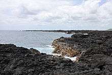
View of Cape Kumukahi
Cape Kumukahi is the easternmost point of the Big Island of Hawaii.[1] It constitutes the eastern end of the East Rift Zone of Kīlauea which is prolonged under the sea beyond the course via the edge of Puna.[2]
Cape Kumukahi Light is located in the cape.
References
This article is issued from
Wikipedia.
The text is licensed under Creative Commons - Attribution - Sharealike.
Additional terms may apply for the media files.