Harrisonville, New Jersey
| Harrisonville, New Jersey | |
|---|---|
| Unincorporated community | |
 United States Census Bureau map of Harrisonville, New Jersey | |
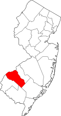
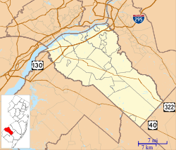 Harrisonville Harrisonville's location in Gloucester County (Inset: Gloucester County in New Jersey)  Harrisonville Harrisonville (New Jersey)  Harrisonville Harrisonville (the US) | |
| Coordinates: 39°41′06″N 75°15′58″W / 39.68500°N 75.26611°WCoordinates: 39°41′06″N 75°15′58″W / 39.68500°N 75.26611°W | |
| Country |
|
| State |
|
| County | Gloucester |
| Township | South Harrison |
| Elevation | 82 ft (25 m) |
| ZIP code | 08039 |
| GNIS feature ID | 0876971[1] |
Harrisonville is an unincorporated community located within South Harrison Township, in Gloucester County, New Jersey, United States.[2] The area is served as United States Postal Service ZIP code 08039.
As of the 2000 United States Census, the population for ZIP Code Tabulation Area 08039 was 153.[3]
Harrisonville is located at 39°41′06″N 75°15′58″W / 39.68500°N 75.26611°W.[4]
References
- ↑ "Harrisonville". Geographic Names Information System. United States Geological Survey. Retrieved October 6, 2012.
- ↑ Locality Search, State of New Jersey. Accessed June 9, 2016.
- ↑ Census 2000 Fact Sheet for ZIP Code Tabulation Area 08039 from the United States Census Bureau. Accessed June 20, 2008.
- ↑ U.S. Geological Survey Geographic Names Information System: HarrisonVille, Geographic Names Information System. Accessed June 20, 2008.
External links
This article is issued from
Wikipedia.
The text is licensed under Creative Commons - Attribution - Sharealike.
Additional terms may apply for the media files.