Harriett, Texas
| Harriett | |
|---|---|
| Unincorporated community | |
 Harriett Location within the state of Texas  Harriett Harriett (the US) | |
| Coordinates: 31°32′50″N 100°19′7″W / 31.54722°N 100.31861°WCoordinates: 31°32′50″N 100°19′7″W / 31.54722°N 100.31861°W | |
| Country | United States |
| State | Texas |
| County | Tom Green |
| Time zone | UTC-6 (Central (CST)) |
| • Summer (DST) | UTC-5 (CDT) |
| GNIS feature ID | 1379899 |
Harriett, is an unincorporated community in northeastern Tom Green County in the U.S. state of Texas. It is part of the 'San Angelo, Texas Metropolitan Statistical Area'. It is next to U.S. Highway 67.
The town started when Charles P. Lovelace as postmaster established a post office in the location which would become the town in 1909. A month later, the post office changed its name from Harriet to Harriett and continued to served the area until it was moved to San Angelo in 1927. The community reported a population of 12 and two businesses in 1936, and county maps of the 1950s showed a church and several buildings there. Harriett was shown on the 1984 county highway map with a railroad station and, two miles northeast, a cemetery.[1]
References
- ↑ Charles G. Davis. The Handbook of Texas Online , Retrieved 2013-05-24.
External links
Municipalities and communities of Tom Green County, Texas, United States | ||
|---|---|---|
| City | 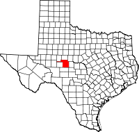 | |
| CDPs | ||
| Other unincorporated communities | ||
| Ghost town | ||
This article is issued from
Wikipedia.
The text is licensed under Creative Commons - Attribution - Sharealike.
Additional terms may apply for the media files.