Hardyville, Kentucky
| Hardyville, Kentucky | |
|---|---|
| Census-designated place | |
 Hardyville  Hardyville | |
| Coordinates: 37°15′15″N 85°47′10″W / 37.25417°N 85.78611°WCoordinates: 37°15′15″N 85°47′10″W / 37.25417°N 85.78611°W | |
| Country | United States |
| State | Kentucky |
| County | Hart |
| Area | |
| • Total | 0.64 sq mi (1.66 km2) |
| • Land | 0.63 sq mi (1.63 km2) |
| • Water | 0.008 sq mi (0.02 km2) |
| Elevation | 702 ft (214 m) |
| Population (2010) | |
| • Total | 156 |
| • Density | 247/sq mi (95.4/km2) |
| Time zone | UTC-6 (Central (CST)) |
| • Summer (DST) | UTC-5 (CST) |
| ZIP code | 42746 |
| Area code(s) | 270 & 364 |
| FIPS code | 21-34660 |
| GNIS feature ID | 493738[1] |
Hardyville is a small unincorporated community and census-designated place (CDP) in Hart County, Kentucky, United States, located east of Munfordville on U.S. Route 31E. As of the 2010 census it had a population of 156.[2]
A post office was established in the community in 1868.[3] It was named in honor of a series of popular stump speeches given at the crossroads during the 1850s by local politician James Greene Hardy, Lieutenant Governor of Kentucky from 1855 to 1856.
References
- ↑ U.S. Geological Survey Geographic Names Information System: Hardyville, Kentucky
- ↑ "Geographic Identifiers: 2010 Demographic Profile Data (G001): Hardyville CDP, Kentucky". American Factfinder. U.S. Census Bureau. Retrieved June 30, 2017.
- ↑ Rennick, Robert M. (1987). Kentucky Place Names. University Press of Kentucky. pp. 131–132. ISBN 0813126312. Retrieved 2013-04-28.
Municipalities and communities of Hart County, Kentucky, United States | ||
|---|---|---|
| Cities | 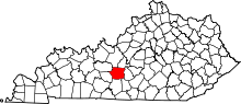 | |
| CDP | ||
| Other unincorporated communities | ||
This article is issued from
Wikipedia.
The text is licensed under Creative Commons - Attribution - Sharealike.
Additional terms may apply for the media files.