Harbinger, North Carolina
| Harbinger, North Carolina | |
|---|---|
| Unincorporated community | |
 Harbinger, North Carolina  Harbinger, North Carolina | |
| Coordinates: 36°06′08″N 75°48′51″W / 36.10222°N 75.81417°WCoordinates: 36°06′08″N 75°48′51″W / 36.10222°N 75.81417°W | |
| Country | United States |
| State | North Carolina |
| County | Currituck |
| Elevation | 13 ft (4 m) |
| Time zone | UTC-5 (Eastern (EST)) |
| • Summer (DST) | UTC-4 (EDT) |
| ZIP code | 27941 |
| Area code(s) | 252 |
| GNIS feature ID | 1020616[1] |
Harbinger is an unincorporated community in Currituck County, North Carolina, United States. The community is located along U.S. Highway 158 near the southern tip of the peninsula which forms mainland Currituck County. Harbinger has a post office with ZIP code 27941.[2][3]
References
- ↑ "Harbinger". Geographic Names Information System. United States Geological Survey.
- ↑ United States Postal Service (2015). "USPS - Look Up a ZIP Code". Retrieved February 8, 2015.
- ↑ "Postmaster Finder - Post Offices by ZIP Code". United States Postal Service. Retrieved February 8, 2015.
Municipalities and communities of Currituck County, North Carolina, United States | ||
|---|---|---|
| CDPs | 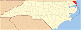 | |
| Unincorporated communities | ||
This article is issued from
Wikipedia.
The text is licensed under Creative Commons - Attribution - Sharealike.
Additional terms may apply for the media files.