Hanumannagar Yoginimai
| Hanumannagar Kankalini हनुमाननगर कंकालिनी | |
|---|---|
| Municipality | |
 | |
 Hanumannagar Kankalini Location in Nepal | |
| Coordinates: 26°30′21″N 86°51′35″E / 26.5059°N 86.8597°ECoordinates: 26°30′21″N 86°51′35″E / 26.5059°N 86.8597°E | |
| Country |
|
| Zone | Sagarmatha |
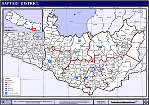
| District | Saptari District |
| Government | |
| • Mayor | Sailesh Sah[1] |
| • Vice-Mayor | Sarita Devi Yadav Sipaliya[2] |
| Population (2011) | |
| • Total | 20,915 |
| Time zone | UTC+5:45 (NST) |
| Postal code | 54600 |
| Area code(s) | 031 |
| Website | http://hanumannagarkankalinimun.gov.np |
Hanumannagar Kankalinimai[3] is a municipality of Saptari District in Sagarmatha Zone of eastern Nepal. The municipality was established on 19 September 2015 by merging the existing Hanuman Nagar, Joginiya-1, Joginiya-2, Gobargada and Inarwa village development committees (VDCs).[4][5] The center of the municipality is establish in the mid of Hanumannagar Bazaar. After merging the five VDCs population it had a total population of 20,915 according to 2011 Nepal census.[6] After the government decision the number of municipalities has reached 217 in Nepal.[7]
References
- ↑ <URL=http://kantipur.ekantipur.com/news/2017-09-23/20170923195412.html>
- ↑ <URL=http://kantipur.ekantipur.com/news/2017-09-23/20170923195412.html>
- ↑ "Govt declares 26 new municipalities". EKantipur. 19 September 2015.
- ↑ "26 new Municipalities announced". The Rising Nepal. Retrieved 2015-09-18.
- ↑ "Govt announces 26 municipalities" (PDF). The Kathmandu Post. Archived from the original (PDF) on 2015-10-01. Retrieved 2015-09-18.
- ↑ Central Bureau of Statistics of Nepal: National Population and Housing Census 2011 Archived 2013-09-27 at the Wayback Machine.
- ↑ "Govt adds 26 municipalities, 1 sub metropolis". Setopati. Retrieved 18 September 2015.
External links
This article is issued from
Wikipedia.
The text is licensed under Creative Commons - Attribution - Sharealike.
Additional terms may apply for the media files.