Hanover, Maryland
| Hanover, Maryland | |
|---|---|
| Unincorporated community | |
 Arundel Mills Mall in Hanover | |
 Hanover Location within the state of Maryland  Hanover Hanover (the US) | |
| Coordinates: 39°11′34″N 76°43′27″W / 39.19278°N 76.72417°WCoordinates: 39°11′34″N 76°43′27″W / 39.19278°N 76.72417°W | |
| Country |
|
| State |
|
| County |
|
| Established | April 30, 1862[1] |
| Population (2010) | |
| • Total | 12,952[2] |
| • Density | 2,720/sq mi (1,049/km2) |
| Time zone | UTC-5 (Eastern (EST)) |
| • Summer (DST) | UTC-4 (EDT) |
| Zip Code | 21076 |
| Area code(s) | 410, 443 |
Hanover, Maryland is an unincorporated community in the Baltimore/Annapolis area in northwestern Anne Arundel County, Maryland and eastern Howard County, Maryland in the United States, located south of Baltimore on the Howard County line.
It is located approximately at the intersection of Maryland State Highway 100 and the Baltimore-Washington Parkway. It is part of the Baltimore-Washington Metropolitan Area and is located just southwest of the Baltimore-Washington International Thurgood Marshall Airport (commonly known as "BWI"). It is bordered by Severn to the south, Linthicum to the east, Baltimore to the northeast, Ft. Meade to the west, and Columbia to the north.
History
In the past, the community also consisted of "Anderson", a post office stop founded along the B&O tracks from 1874–1881 along modern Anderson Avenue, and operated as "Hanoverville" until December 1896.[3]
Hanover is located along the fall line where the ocean met the shore in prehistoric times. Native American tribes lived along the lower Patapsco river. archeological digs in 1929 have discovered arrowheads, spearpoints, axes, and gorgets along the Disney farm. The area is now occupied by commercial buildings along Hi Tech drive and Oxford Square development.[4]
Arundel Mills mall opened in November 2000. Since then, the area has seen explosive growth; shopping centers and housing developments have popped up along Arundel Mills Boulevard (Route 713), which links the B-W Parkway and Route 100 to Arundel Mills. In August 2010, Preston Partners sought to rezone a failed commercial project on the historic Disney farm into a transit-oriented development funded by Magic Johnson.[5] On November 2, 2010, Anne Arundel County voters approved zoning for a gaming and entertainment complex with 4,750 slot machines at Arundel Mills Mall. This casino complex opened as Maryland Live! in June 2012. The Maryland Department of Transportation is headquartered at 7201 Corporate Center Drive, which has a Hanover address.[6]
Schools
| Historical population | |||
|---|---|---|---|
| Census | Pop. | %± | |
| 1990 | 9,572 | — | |
| 2000 | 11,083 | 15.8% | |
| 2010 | 12,952 | 16.9% | |
| source:[2] | |||
Hanover is served by the Anne Arundel County Public Schools and Howard County Public Schools system.
- Thomas Viaduct Middle School (6–8, opening fall 2014, Only for students residing in the Howard County portion of Hanover.)
- Frank Hebron-Harman Elementary School (Pre-K–5)
- Linthicum Elementary School (Linthicum, MD) (Pre-K–5)
- Chesapeake Science Point (6–12)
- MacArthur Middle School (Ft. Meade, MD) (6–8)
- Lindale Middle School (Linthicum, MD) (6–8)
- Meade High School (Ft. Meade, MD) (9–12)
- North County High School (Glen Burnie, MD) (9–12)
- Howard High School (Columbia, MD) (9–12) (Only for students residing in the Howard County portion of Hanover.)
Real estate developments
- Arundel Mills mall and Maryland Live! casino
- Hawks Ridge/Forest Ridge, a large community with medium and large single family homes, constructed by Ryan Homes from the 1990s – mid 2000s.
- Dorsey Ridge Luxury Apartments and Villas – opened in 2013[7]
- Parkside Townhomes[8]
- Stoney Run Garden condominiums
- Villages of Dorchester, a residential development
- Arundel Preserve, a mixed-use development that at completion will include about two million square feet of office space, 500 apartments, 440 homes, 300,000 square feet (30,000 m2) of retail space, and two hotels near Arundel Mills mall.[9]
- Ridgefield I and II, constructed by Rice Homes and Washington Homes in the late 1970s and early 1980s
- Ridgewood, constructed by Washington Homes in the early 1980s featuring homes with 1-acre (4,000 m2) lots
- Shipley Homestead, a residential development
References
- ↑ https://web.archive.org/web/20140518050030/http://www.postalmuseum.si.edu/statepostalhistory/Maryland_Post_Offices.pdf
- 1 2 "Hanover (zip 21076), Maryland People".
- ↑ "Smithsonian National Postal Museum" (PDF). Retrieved 17 May 2014.
- ↑ Richard E Stearns (1949). Proceedings of the Natural History Society of Maryland number 10 Some Indian Village Sites of the Lower Patapsco River.
- ↑ "Canyon-Johnson Urban Funds Partners with Preston Capital Management to Purchase 122 Acres in the Baltimore-Washington Corridor Plans Move Forward for the Development of a Transit-Oriented Community in the City of Hanover". Retrieved 10 June 2014.
- ↑ "MDOT Departments Archived 2009-03-21 at the Wayback Machine.." Maryland Department of Transportation. Retrieved on March 23, 2009.
- ↑ dorseyridge.com
- ↑ "Parkside – New Townhomes for Sale In Hanover, MD".
- ↑ "Massive project set for Arundel". Baltimore Business Journal. February 28, 2005.
External links

 |
Dorsey | Elkridge | Linthicum |
| |||
| Jessup | Glen Burnie | ||||||
| North Laurel | Fort Meade | Severn |

Municipalities and communities of Howard County, Maryland, United States | ||
|---|---|---|
| CDPs | 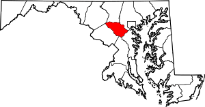 | |
| Villages | ||
| Unincorporated communities |
| |
| Footnotes | ‡This populated place also has portions in an adjacent county or counties | |