Hangum
| Hangum हाङगुम | |
|---|---|
| Village development committee | |
 Hangum Location in Nepal | |
| Coordinates: 26°57′N 87°35′E / 26.95°N 87.59°ECoordinates: 26°57′N 87°35′E / 26.95°N 87.59°E | |
| Country |
|
| Zone | Mechi Zone |
| District | Panchthar District |
| Population (1991) | |
| • Total | 2,925 |
| Time zone | UTC+5:45 (Nepal Time) |
Hangum is a village development committee in Panchthar District in the Mechi Zone of eastern Nepal. At the time of the 1991 Nepal census it had a population of 2925 people living in 526 individual households.[1]
Aarubote VDC in to the east, Mouwa VDC and Olane VDC in the north, Limba and Durdimba in the South respectively.
References
- ↑ "Nepal Census 2001". Nepal's Village Development Committees. Digital Himalaya. Retrieved 12 December 2008.
Headquarter: Phidim | ||
| Rural Municipalities | 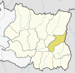 | |
| Municipalities | ||
This article is issued from
Wikipedia.
The text is licensed under Creative Commons - Attribution - Sharealike.
Additional terms may apply for the media files.