Hamat
| Hamat حامات | |
|---|---|
| City | |
 Hamat Location within Lebanon | |
| Coordinates: 34°17′N 35°41′E / 34.283°N 35.683°ECoordinates: 34°17′N 35°41′E / 34.283°N 35.683°E | |
| Country |
|
| Governorate | North Governorate |
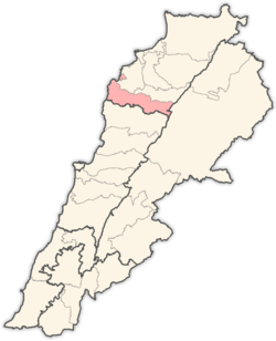
| District | Batroun District |
| Elevation | 287 m (942 ft) |
| Time zone | UTC+2 (EET) |
| • Summer (DST) | UTC+3 (EEST) |
| Dialing code | +961 |
Hamat is a village in Lebanon. It is located 287 meters atop the historic cape of Theoprosopon. It is home to the historic shrine and monastery of Our Lady of Nourieh. The village is also home to Saint Elias Church, which overlooks the Jawz River, or the River of Walnuts and the ancient Phoenician coastal town of Batroun. The locals are Orthodox Christians.[1]
References
External links
- Hamat, Localiban
Capital: Batroun | ||
| Towns and villages |
|  |
This article is issued from
Wikipedia.
The text is licensed under Creative Commons - Attribution - Sharealike.
Additional terms may apply for the media files.