Haggart Creek (Muskoka District)
| Haggart Creek | |
| River | |
| Country | Canada |
|---|---|
| Province | Ontario |
| Region | Central Ontario |
| District | Muskoka |
| Municipalities | Muskoka Lakes, Georgian Bay |
| Part of | Great Lakes Basin |
| Source | Haggart Lake |
| - location | Muskoka Lakes |
| - elevation | 234 m (768 ft) [1] |
| - coordinates | 45°06′31″N 79°44′23″W / 45.10848482998722°N 79.7396687689496°W[2] |
| Mouth | Moon River |
| - location | Georgian Bay, Ontario |
| - elevation | 209 m (686 ft) [1] |
| - coordinates | 45°02′59″N 79°44′29″W / 45.04972°N 79.74139°WCoordinates: 45°02′59″N 79°44′29″W / 45.04972°N 79.74139°W [3] |
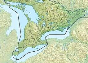 Location of the mouth of the creek in Southern Ontario | |
Haggart Creek is a creek in the municipalities of Georgian Bay and Muskoka Lakes, District Municipality of Muskoka in Central Ontario, Canada.[3][2][4][5][6] It is in the Great Lakes Basin and is a right tributary of the Moon River.
Course
The creek begins at the east end of Haggart Lake, in geographic Medora Township in the municipality of Muskoka Lakes, and flows east under the Canadian Pacific Railway main line to Cassidy Lake, leaves that lake at the south heading south, passes again under the CP railway, and reaches the eastern end of Roderick Lake. It exits the lake at the southeast at the railway point of Duffy, flows southeast to the western side of Duffy Lakes, turns southwest, enters geographic Gibson Township in the municipality of Georgian Bay, and reaches its mouth at the Moon River. The Moon River flows to Georgian Bay on Lake Huron.[3][2][4]
References
- 1 2 "Google Earth". Retrieved 2018-08-11.
- 1 2 3 "Toporama". Atlas of Canada. Natural Resources Canada. Retrieved 2018-08-11.
- 1 2 3 "Haggart Creek". Geographical Names Data Base. Natural Resources Canada. Retrieved 2018-08-11.
- 1 2 "CLAIMaps IV". Ontario Ministry of Northern Development and Mines. 2016. Retrieved 2018-08-11.
- ↑ Map 5 (PDF) (Map). 1 : 700,000. Official road map of Ontario. Ministry of Transportation of Ontario. 2016-01-01. Retrieved 2018-08-11.
- ↑ Restructured municipalities - Ontario map #4 (Map). Restructuring Maps of Ontario. Ontario Ministry of Municipal Affairs and Housing. 2006. Retrieved 2018-08-11.