Hagere Selam (Degua Tembien)
| Hagere Selam | ||
|---|---|---|
 | ||
| ||
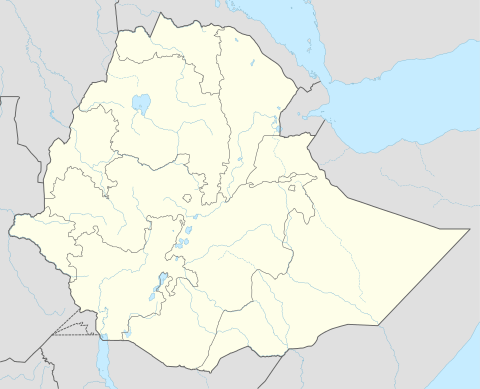 Hagere Selam Location within Ethiopia | ||
| Coordinates: 13°39′N 39°10′E / 13.650°N 39.167°ECoordinates: 13°39′N 39°10′E / 13.650°N 39.167°E | ||
| Country | Ethiopia | |
| Region | Tigray | |
| Zone | Mehakelegnaw (Central) | |
| Woreda | Degua Tembien | |
| Area | ||
| • Total | 5.23 km2 (2.02 sq mi) | |
| Elevation | 2,625 m (8,612 ft) | |
| Population (2005 (est.)) | ||
| • Total | 6,797 | |
| Time zone | UTC+3 (EAT) | |
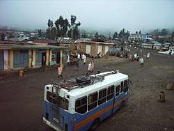
Hagere Selam (meaning place of peace) is a town in northern Ethiopia. Located in the Tembien area of the Tigray Region on the Mekelle-Abiy Addi regional road, it has a longitude and latitude of 13°39′N 39°10′E / 13.650°N 39.167°E with an elevation of 2625 meters above sea level. The town is the administrative center of Degua Tembien woreda.
Hagere Selam is located on the saddle point between two of the highest points in Tigray. The regional road from Mekelle to Abiy Addi travels through Hagere Selam, before going down to the Abergele lowlands. The area is categorized as highland or dega. In Hagere Selam, a local road diverts from the regional road to join the Abiy Addi - Adwa road in the northwest near Kechemo. The local economy is dependent on agriculture, with barley being the main crop grown in the area, and on apiculture.
Demographics
Based on figures from the Central Statistical Agency in 2005, Hagere Selam has an estimated total population of 6,797, of whom 2,988 are men and 3,809 are women.[1] The 1994 census reported it had a total population of 3932, of whom 1591 were men and 2341 were women.
References
- ↑ CSA 2005 National Statistics, Table B.4