Hůrky
| Hůrky | |||
|---|---|---|---|
| Municipality | |||
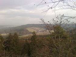 Hůrky as seen from Mt. Žďár (629 m) | |||
| |||
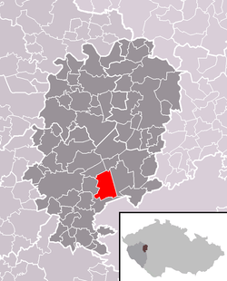 Location of Hůrky within Rokycany District | |||
 Hůrky Location of Hůrky within Czech Republic | |||
| Coordinates: 49°44′49″N 13°41′18″E / 49.74694°N 13.68833°ECoordinates: 49°44′49″N 13°41′18″E / 49.74694°N 13.68833°E | |||
| Country |
| ||
| Region | Plzeň | ||
| District | Rokycany | ||
| Area | |||
| • Total | 12.07 km2 (4.66 sq mi) | ||
| Elevation | 469 m (1,539 ft) | ||
| Population (2015-01-01) | |||
| • Total | 234 | ||
| • Density | 19/km2 (50/sq mi) | ||
| Postal code | 338 01 | ||
.svg.png)
.svg.png)
Hůrky (Czech pronunciation: [ˈɦuːrkɪ]) is a village and municipality (obec) in Rokycany District in the Plzeň Region of the Czech Republic.
The municipality covers an area of 12.07 square kilometres (4.66 sq mi), and has a population of 226 (as at 31 December 2008).
Hůrky lies approximately 7 kilometres (4 mi) east of Rokycany, 23 km (14 mi) east of Plzeň, and 65 km (40 mi) south-west of Prague.
References
This article is issued from
Wikipedia.
The text is licensed under Creative Commons - Attribution - Sharealike.
Additional terms may apply for the media files.