Hüllhorst
| Hüllhorst | ||
|---|---|---|
| ||
 Hüllhorst Location of Hüllhorst within Minden-Lübbecke district 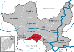  | ||
| Coordinates: 52°17′N 08°40′E / 52.283°N 8.667°ECoordinates: 52°17′N 08°40′E / 52.283°N 8.667°E | ||
| Country | Germany | |
| State | North Rhine-Westphalia | |
| Admin. region | Detmold | |
| District | Minden-Lübbecke | |
| Government | ||
| • Mayor | Wilhelm Henke (SPD) | |
| Area | ||
| • Total | 44.73 km2 (17.27 sq mi) | |
| Elevation | 115 m (377 ft) | |
| Population (2016-12-31)[1] | ||
| • Total | 13,078 | |
| • Density | 290/km2 (760/sq mi) | |
| Time zone | CET/CEST (UTC+1/+2) | |
| Postal codes | 32609 | |
| Dialling codes | 05744 | |
| Vehicle registration | MI | |
| Website | www.huellhorst.de | |

Hüllhorst is a municipality in the Minden-Lübbecke district, in North Rhine-Westphalia, Germany.
Geography
Hüllhorst is situated on the south side of the Wiehengebirge, approx. 5 km south-east of Lübbecke and 20 km west of Minden.
Neighbouring places
Division of the municipality
Hüllhorst consists of 9 districts (Population as of December 31, 2006):
- Ahlsen-Reineberg (1,009 inhabitants)
- Bröderhausen (687 inhabitants)
- Büttendorf (794 inhabitants)
- Holsen (1,080 inhabitants)
- Huchzen (45 inhabitants)
- Hüllhorst (2,761 inhabitants)
- Oberbauerschaft (2,998 inhabitants)
- Schnathorst (2,850 inhabitants)
- Tengern (2,038 inhabitants)
References
- ↑ "Amtliche Bevölkerungszahlen" (in German). Landesbetrieb Information und Technik NRW. Retrieved 2018-02-24.
External links
- Official site (in German)
Towns and municipalities in Minden-Lübbecke | ||
|---|---|---|
This article is issued from
Wikipedia.
The text is licensed under Creative Commons - Attribution - Sharealike.
Additional terms may apply for the media files.