Höllpass
| Höllpass | |
|---|---|
 Summit of the pass | |
| Elevation | 683 m (2,241 ft) |
| Traversed by | Staatsstraße 2180 |
| Location | Districts of Bayreuth and Wunsiedel im Fichtelgebirge in Bavaria, Germany |
| Range | Fichtel Mountains |
| Coordinates | 50°05′46″N 11°48′46″E / 50.0961°N 11.8129°ECoordinates: 50°05′46″N 11°48′46″E / 50.0961°N 11.8129°E |
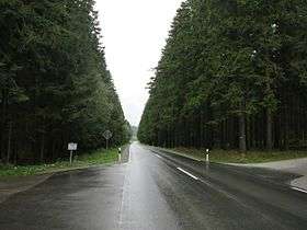
The Höllpass is a 683 m[1] high mountain pass in the northern part of the Fichtel Mountains in Bavaria, Germany.
The Höllpass is located in the northwest of the horseshoe-shaped Fichtelgebirge range, the horseshoe being open to the east. It lies between the ridges of the Waldstein to the north and the Schneeberg–Ochsenkopf Massif to the south, which were formed almost at right angles to the tectonic fault lines in the Fichtelgebirge.
The road running over the Höllpass – state road (Staatsstraße) number 2180 – climbs about 120 metres (390 ft) from the Kornbach valley near Gefrees to Torfmoorhölle in the borough of Weißenstadt.
See also
References
- ↑ Map services Archived December 19, 2012, at the Wayback Machine. of the BfN
This article is issued from
Wikipedia.
The text is licensed under Creative Commons - Attribution - Sharealike.
Additional terms may apply for the media files.