Hébertville, Quebec
| Hébertville | |
|---|---|
| Municipality | |
 | |
 | |
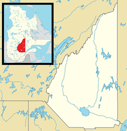 Hébertville Location in Saguenay–Lac-Saint-Jean Quebec. | |
| Coordinates: 48°24′N 71°41′W / 48.400°N 71.683°WCoordinates: 48°24′N 71°41′W / 48.400°N 71.683°W[1] | |
| Country |
|
| Province |
|
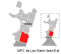
| Region | Saguenay–Lac-Saint-Jean |
| RCM | Lac-Saint-Jean-Est |
| Constituted | December 16, 1972 |
| Government[2] | |
| • Mayor | Martin Bergeron |
| • Federal riding | Lac-Saint-Jean |
| • Prov. riding | Lac-Saint-Jean |
| Area[2][3] | |
| • Total | 268.80 km2 (103.78 sq mi) |
| • Land | 261.44 km2 (100.94 sq mi) |
| Population (2011)[3] | |
| • Total | 2,441 |
| • Density | 9.3/km2 (24/sq mi) |
| • Pop 2006-2011 |
|
| • Dwellings | 1,204 |
| Time zone | UTC−5 (EST) |
| • Summer (DST) | UTC−4 (EDT) |
| Postal code(s) | G8N 1S8 |
| Area code(s) | 418 and 581 |
| Highways |
|
| Climate | Dfb |
| Website |
www |
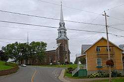
Hébertville is a municipality in Quebec, Canada.
History
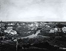
Hébertville in 1906
Hébertville was founded in 1849. It was the first establishment to be colonised in the Lac Saint-Jean area. This municipality offered a future development near the Aulnaies Falls, situated at the heart of the village.
At this location, saw and flour mills were constructed to provide work and food for the first inhabitants.
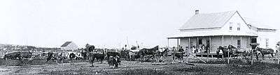 Eusèbe Simard farm in Hébertville around 1906 |
See also
References
- ↑ Reference number 28325 of the Commission de toponymie du Québec (in French)
- 1 2 Ministère des Affaires municipales, des Régions et de l'Occupation du territoire - Répertoire des municipalités: Hébertville
- 1 2 "Hébertville census profile". 2011 Census data. Statistics Canada. Retrieved 2010-10-29.
External links
![]()
Adjacent Municipal Subdivisions | |
|---|---|
| Cities | |
|---|---|
| Municipalities | |
| Parishes | |
| Villages | |
| Unorganized territories | |
| |
This article is issued from
Wikipedia.
The text is licensed under Creative Commons - Attribution - Sharealike.
Additional terms may apply for the media files.