Guttenberg, Bavaria
| Guttenberg | ||
|---|---|---|
 Guttenberg Castle | ||
| ||
 Guttenberg Location of Guttenberg within Kulmbach district 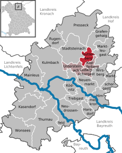 | ||
| Coordinates: 50°8′N 11°34′E / 50.133°N 11.567°ECoordinates: 50°8′N 11°34′E / 50.133°N 11.567°E | ||
| Country | Germany | |
| State | Bavaria | |
| Admin. region | Oberfranken | |
| District | Kulmbach | |
| Municipal assoc. | Untersteinach | |
| Government | ||
| • Mayor | Eugen Hain (CSU) | |
| Area | ||
| • Total | 10.66 km2 (4.12 sq mi) | |
| Elevation | 452 m (1,483 ft) | |
| Population (2017-12-31)[1] | ||
| • Total | 476 | |
| • Density | 45/km2 (120/sq mi) | |
| Time zone | CET/CEST (UTC+1/+2) | |
| Postal codes | 95358 | |
| Dialling codes | 09225 | |
| Vehicle registration | KU | |
| Website | www.gemeinde-guttenberg.de | |

Guttenberg is a municipality in the district of Kulmbach in Bavaria in Germany.
The town is closely tied to House of Guttenberg, who have been associated with the locality since the Middle Ages and still own most of the land in the area.
A landmark in the municipality is the Guttenberg Castle, the seat of the Guttenberg family.
The municipality's coat of arms is derived from that of the Guttenberg family.
Famous people
- Enoch zu Guttenberg (1946–2018), conductor
- Karl-Theodor zu Guttenberg (born 1971), his son, CSU politician and former Federal Minister, at the center of a plagiarism scandal.
Neighbourhoods
Guttenberg is made up of the following neighbourhoods:
|
|
References
- ↑ "Fortschreibung des Bevölkerungsstandes". Bayerisches Landesamt für Statistik und Datenverarbeitung (in German). September 2018.
This article is issued from
Wikipedia.
The text is licensed under Creative Commons - Attribution - Sharealike.
Additional terms may apply for the media files.