Gurramkonda
| Gurramkunda | |
|---|---|
| Village khandriga | |
 Nawab Mir Raza Ali Khan's tomb, Maqbira, Gurramkonda | |
 Gurramkunda Location in Andhra Pradesh, India  Gurramkunda Gurramkunda (India) | |
| Coordinates: 13°47′00″N 78°35′00″E / 13.7833°N 78.5833°ECoordinates: 13°47′00″N 78°35′00″E / 13.7833°N 78.5833°E | |
| Country | India |
| State | Andhra Pradesh |
| District | Chittoor |
| Mandal | Gurramkonda |
| Population | |
| • Total | 15,158 |
| Languages | |
| • Official | Telugu |
| Time zone | UTC+5:30 (IST) |
| Vehicle registration | AP |
Gurramkonda is a village in Chittoor district of the Indian state of Andhra Pradesh. It is the mandal headquarters of Gurramkonda mandal.[1] Gurramkonda Fort is one of the oldest fort in the district.[2]
Geography
Gurramkonda is located at 13°47′00″N 78°35′00″E / 13.7833°N 78.5833°E. It has an average elevation of 647 metres (2,123 ft).[3]
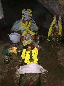
Sanctum Sanctorum
Transport
The National Highway 340 passes though the village, which connects Rayachoti and Kurabalakunta road of Andhra Pradesh.[4]
References
- ↑ "Chittoor District Mandals" (PDF). Census of India. pp. 446, 509. Retrieved 19 June 2015.
- ↑ "Many Chittoor temples, forts in a shambles". Times of India. Tirupati. 28 May 2010. Retrieved 19 June 2015.
- ↑ "Gurramkonda, India Page". fallingrain.com.
- ↑ "List of National Highways passing through A.P. State". Roads and Buildings Department. Government of Andhra Pradesh. Archived from the original on 28 March 2016. Retrieved 11 February 2016.
| Wikimedia Commons has media related to Gurramkonda. |
This article is issued from
Wikipedia.
The text is licensed under Creative Commons - Attribution - Sharealike.
Additional terms may apply for the media files.