Guangdong Provincial People's Stadium
 | |
| Former names | Guangzhou Public Stadium |
|---|---|
| Location | Guangzhou, People's Republic of China |
| Owner | Guangzhou Government |
| Capacity | 15,000 |
| Surface | Grass |
| Construction | |
| Opened | 1932 |
| Renovated |
1946 1950s–60s 1990 |
| Tenants | |
|
Guangdong Sunray Cave (2010–2014) Guangzhou Evergrande (1998–2000) | |
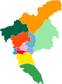
The Guangdong Provincial People's Stadium (Chinese: 广东省人民体育场) is a multi-purpose stadium in Guangzhou, China. It is currently used mostly for football matches. The stadium holds 15,000 people. The stadium is best reached by taking Guangzhou Metro Line 1 to Martyrs' Park Station.[1]
History
Formerly known as the dongjiaochang or Eastern Parade Ground, the site was first used as a sporting venue in 1906 when it hosted Guangdong's (and China’s) first ever provincial level athletics competition. Sun Yat-Sen ordered the construction of a stadium on the site in 1922 but it wasn't finished until 1932.[2]
It was used as a Japanese transport and supplies depot during the occupation of Guangzhou and was bombed when Guangzhou was liberated.
Construction of Yuexiushan meant that the People's Stadium didn't hold many high profile sporting or civic events from the mid 1950s onwards.[3] However, it did host many games in the Guangdong-Hong Kong Cup as well as games in the inaugural Women's World Cup in 1991.[2]
Recent use
For the 2017 Chinese Super League Season, Guangzhou R&F F.C. used the stadium as their temporary home for their first two matches whilst Yuexiushan was being refurbished.[4]
References
- ↑ 广东省人民体育场 at guangzhou.alltrip.cn Retrieved 2014-09-01
- 1 2 "From the Qing dynasty, to collapsing roofs and the CSL: a history of Guangzhou R&F's temporary home". Wild East Football. 2017-03-10. Retrieved 2017-04-05.
- ↑ "Yuexiushan: The cradle of Cantonese football, part one". Wild East Football. 2016-09-13. Retrieved 2017-04-05.
- ↑ "Alexandre Pato the villain as Tianjin Quanjian lose CSL opener to Guangzhou R&F". Wild East Football. 2017-03-04. Retrieved 2017-04-05.
External links
- Guangdong Provincial People's Stadium at Sports.qq.com
Coordinates: 23°07′38″N 113°16′43″E / 23.127189°N 113.278721°E

