Gridley, California
| City of Gridley | |
|---|---|
| General Law City | |
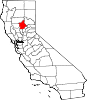
 Location of Gridley in Butte County, California. | |
 City of Gridley Location in the United States | |
| Coordinates: 39°21′50″N 121°41′37″W / 39.36389°N 121.69361°WCoordinates: 39°21′50″N 121°41′37″W / 39.36389°N 121.69361°W | |
| Country |
|
| State |
|
| County | Butte |
| Incorporated | November 23, 1905[1] |
| Named for | George W. Gridley |
| Government | |
| • Mayor | Frank Hall |
| • Administrator | Paul Eckert |
| • State Senator | Jim Nielsen (R)[2] |
| • CA Assembly | James Gallagher (R)[3] |
| • U. S. Congress | Doug LaMalfa (R)[4] |
| Area[5] | |
| • Total | 2.08 sq mi (5.40 km2) |
| • Land | 2.08 sq mi (5.40 km2) |
| • Water | 0.00 sq mi (0.00 km2) 0% |
| Elevation[6] | 95 ft (29 m) |
| Population (2010)[7] | |
| • Total | 6,584 |
| • Estimate (2017)[8] | 6,704 |
| • Density | 3,160.27/sq mi (1,220.30/km2) |
| Time zone | UTC-8 (Pacific) |
| • Summer (DST) | UTC-7 (PDT) |
| ZIP code | 95948 |
| Area code | 530 |
| FIPS code | 06-31260 |
| GNIS feature IDs | 277526, 2410665 |
| Website |
www |
Gridley is a city in Butte County, California, United States. The estimated 2017 population was 6,704. California State Route 99 runs through Gridley and Interstate 5 and California State Route 70 are both nearby.
History
Farming and agricultural industries are historically the most important ventures in the Gridley area. The area remains home to several large manufacturing, general services, and agricultural companies. The overall economic environment has produced a mix of new housing, small and large employers, as well as shopping opportunities. Healthcare also comprises a large sector of the local economy. The beautiful and historic downtown district remains intact. "Silk Stocking Row" the many well-preserved turn-of-the-century homes on Hazel Street, was so named because during the Depression the only women who could afford silk stockings lived in these large Hazel Street homes.
The City of Gridley was named after its founder and earliest landowner, George W. Gridley, a prosperous sheep rancher. Agriculture became a stable and attractive business in the 1860s. The Central Pacific Railroad laid tracks from Oregon to Chico in 1865. The railroad completed its path to Gridley in 1870, contributing significantly to the formation of the new community. The principal products from the Gridley area were wool and sheep. Orchards, field crops, and cattle would soon follow. In 1896, the Libby, McNeil & Libby Cannery was established and became one of the largest peach canning operations in the world. The first home and store in Gridley were built by L.C. Stone in 1874. Stone served as postmaster, the train depot and express agent, as well as a merchant. Wells Fargo & Co. opened its office in 1871 and soon other businesses followed suit.
In response to a "The Place Where Crops Never Fail" advertising campaign by the California Irrigated Land Company, members of The Church of Jesus Christ of Latter-day Saints began emigrating from the Rexburg, Idaho area to Gridley in November 1906. By February of the following year the Gridley Branch of the church was organized and more Latter-day Saints continued coming to Gridley from Idaho, Nevada, Utah and other states, effectively turning this small farming community into a Mormon enclave.[9] By the end of 1908 there were some 500 LDS settlers in the Gridley area and their first chapel was constructed on the west corner of Sycamore and Vermont Streets in 1912 with a seating capacity of 1,000—the largest LDS meetinghouse west of Salt Lake City at that time.[10]
The post office at Martinsburgh was moved to Gridley in 1870.[11]
Geography
According to the United States Census Bureau, the City has a total area of 2.1 square miles (5.4 km2), all land.
Climate
According to the Köppen Climate Classification system, Gridley has a warm-summer Mediterranean climate, abbreviated "Csa" on climate maps.[12]
| Climate data for Gridley | |||||||||||||
|---|---|---|---|---|---|---|---|---|---|---|---|---|---|
| Month | Jan | Feb | Mar | Apr | May | Jun | Jul | Aug | Sep | Oct | Nov | Dec | Year |
| Record high °F (°C) | 70 (21) |
78 (26) |
84 (29) |
95 (35) |
106 (41) |
108 (42) |
113 (45) |
113 (45) |
112 (44) |
101 (38) |
84 (29) |
72 (22) |
113 (45) |
| Average high °F (°C) | 52 (11) |
59 (15) |
63.2 (17.3) |
73.4 (23) |
80.6 (27) |
88 (31) |
96 (36) |
93.5 (34.2) |
89.8 (32.1) |
77.5 (25.3) |
63.4 (17.4) |
54.1 (12.3) |
74.2 (23.4) |
| Average low °F (°C) | 34.8 (1.6) |
37.9 (3.3) |
41.6 (5.3) |
46.3 (7.9) |
52.4 (11.3) |
57.1 (13.9) |
60.9 (16.1) |
58.4 (14.7) |
55.7 (13.2) |
48.3 (9.1) |
40.1 (4.5) |
37.5 (3.1) |
47.6 (8.7) |
| Record low °F (°C) | 19 (−7) |
24 (−4) |
26 (−3) |
28 (−2) |
36 (2) |
42 (6) |
48 (9) |
48 (9) |
42 (6) |
28 (−2) |
20 (−7) |
22 (−6) |
19 (−7) |
| Average precipitation inches (mm) | 5.07 (128.8) |
3.05 (77.5) |
2.62 (66.5) |
1.04 (26.4) |
0.86 (21.8) |
0.26 (6.6) |
0.03 (0.8) |
0.02 (0.5) |
0.36 (9.1) |
0.89 (22.6) |
2.25 (57.2) |
3.72 (94.5) |
20.19 (512.8) |
| Average snowfall inches (cm) | 0.4 (1) |
0.1 (0.3) |
0 (0) |
0 (0) |
0 (0) |
0 (0) |
0 (0) |
0 (0) |
0 (0) |
0 (0) |
0 (0) |
0 (0) |
0.5 (1.3) |
| Average precipitation days (≥ 0.01 inch) | 12 | 9 | 9 | 4 | 4 | 2 | 0 | 0 | 1 | 4 | 6 | 10 | 61 |
| Source: [13] | |||||||||||||
Demographics
| Historical population | |||
|---|---|---|---|
| Census | Pop. | %± | |
| 1880 | 352 | — | |
| 1890 | 686 | 94.9% | |
| 1910 | 987 | — | |
| 1920 | 1,636 | 65.8% | |
| 1930 | 1,941 | 18.6% | |
| 1940 | 2,338 | 20.5% | |
| 1950 | 3,054 | 30.6% | |
| 1960 | 3,343 | 9.5% | |
| 1970 | 3,534 | 5.7% | |
| 1980 | 3,982 | 12.7% | |
| 1990 | 4,631 | 16.3% | |
| 2000 | 5,382 | 16.2% | |
| 2010 | 6,584 | 22.3% | |
| Est. 2016 | 6,586 | [8] | 0.0% |
| U.S. Decennial Census[14] | |||
2010
The 2010 United States Census[15] reported that Gridley had a population of 6,584. The population density was 3,179.1 people per square mile (1,227.4/km²). The racial makeup of Gridley was 4,283 (65.1%) White, 55 (0.8%) African American, 98 (1.5%) Native American, 249 (3.8%) Asian, 3 (0.0%) Pacific Islander, 1,552 (23.6%) from other races, and 344 (5.2%) from two or more races. Hispanic or Latino of any race were 3,000 persons (45.6%).
The Census reported that 6,472 people (98.3% of the population) lived in households, 16 (0.2%) lived in non-institutionalized group quarters, and 96 (1.5%) were institutionalized. There were 2,183 households, out of which 910 (41.7%) had children under the age of 18 living in them, 1,087 (49.8%) were opposite-sex married couples living together, 338 (15.5%) had a female householder with no husband present, 134 (6.1%) had a male householder with no wife present. There were 149 (6.8%) unmarried opposite-sex partnerships, and 8 (0.4%) same-sex married couples or partnerships. 520 households (23.8%) were made up of individuals and 297 (13.6%) had someone living alone who was 65 years of age or older. The average household size was 2.96. There were 1,559 families (71.4% of all households); the average family size was 3.54.
The population was spread out with 1,892 people (28.7%) under the age of 18, 668 people (10.1%) aged 18 to 24, 1,681 people (25.5%) aged 25 to 44, 1,415 people (21.5%) aged 45 to 64, and 928 people (14.1%) who were 65 years of age or older. The median age was 33.1 years. For every 100 females, there were 94.3 males. For every 100 females age 18 and over, there were 91.6 males.
There were 2,406 housing units at an average density of 1,161.7 per square mile (448.5/km²), of which 2,183 were occupied, of which 1,262 (57.8%) were owner-occupied, and 921 (42.2%) were occupied by renters. The homeowner vacancy rate was 2.6%; the rental vacancy rate was 6.5%. 3,829 people (58.2% of the population) lived in owner-occupied housing units and 2,643 people (40.1%) lived in rental housing units.
Business and economy
Farming and agricultural industries are the most important ventures in the Gridley area. The area is home to several large manufacturing, general services, and agricultural companies. The overall environment has produced a mix of new housing, small and large employers, as well as shopping opportunities. Healthcare also comprises a large sector of the local economy.
Arts and culture
Annual events
Red Suspenders Day
Gridley is known as a friendly and industrious farming community with a strong work ethic and an active citizenry. The Gridley Community established the Red Suspenders Day in 1961 as a dance to raise revenue for the volunteer Gridley Firefighters. The annual April event is now a region-wide celebration spanning two days of family fun and events including: The Big Parade; Classic Car Show; Classic Bed Races; Pie Eating Contests; and Children’s Art Activities. The 1-mile-long parade attracts 8,000 attendees and features floats and a procession of parade participants, with a strong focus on public safety.
Holiday tree lighting and parade
The annual late November Tree Lighting Ceremony and Holiday Parade of Lights is focused on the family and includes: Festive Live Music; a Parade of Lights; Craft Fair; Great Food; and Children’s Art Activities.
Farmers market
The farmers market is held every Tuesday evening June through September in beautifully restored Daddow Park in Historic Downtown Gridley. The Market is hosted and run by the Gridley Chamber of Commerce. It offers a large collection of fresh produce as well as baked goods, crafts, food vendors, and live entertainment.
Museums and other points of interest
- Gridley Museum
Government
Gridley is a general law city as opposed to a charter city and operates under a council-administrator form of government. The elected government consists of 5 separately elected City council members. The current mayor is Frank Hall. The current city administrator is Paul Eckert.
Infrastructure
Healthcare
The State of California, Office of Statewide Health Planning and Development defines Orchard Hospital as a General Acute Care Hospital in Gridley with a Level IV Trauma Center and Standby emergency care as of 22 August 2006. The facility is located at (NAD83) latitude/longitude of 39°22′03″N 121°41′22″W / 39.36750°N 121.68944°W. Voters voted against Measure M to fund the Hospital's emergency room for unstated reasons.
Parks
Manuel Vierra Park is located between the far south ends of Haskell and Washington Streets. The 13.5 acre Park offers large areas of shaded grass under a grove of oak trees. Park facilities include a new splash pad, updated restrooms, playground equipment, tennis courts, barbecue facilities, benches and tables, and baseball and softball diamonds. The Park also has a fenced area for children's birthday parties.
Nick Daddow Park is located at Hazel and Virginia Streets. The stunning landmark and Downtown Park has a gazebo, picnic tables shaded by huge cypress and palm trees, and barbecue facilities. Free concerts are often held at the gazebo. The Park is the central site of the Annual Red Suspenders Day event.
Gridley Rotary Park is located on Washington Street between Sycamore and Magnolia Streets. The one acre Park has shade trees, grass and picnic tables.
Skateboard Park is located at the intersection of Washington Street and Spruce Street. The large modern skatepark facility is well used and safely maintained.
Railroad Park is located along Washington Street at Hazel near the Downtown. The Park offers picnic benches, shade trees, and a barbeque area. Just across the street from Railroad Park to the north is Quota Park, a tranquil sitting area that includes a beautiful fountain, benches, and tables.
Boat Launch Park includes a new boat ramp and dock, restrooms, lighting, and a fish cleaning table. It's located 5 minutes east of Gridley on East Gridley Road. The modern facility was largely funded by the California Division of Boating and Waterways.[16]
Nearby Recreation - Excellent hunting, fishing and naturalist opportunities are broadly available in the region. The Gray Lodge Wildlife Waterfowl Management Area is located just 10 miles southwest of Gridley and includes 8,400 acres of the most intensively used and developed wetlands in the entire Pacific Flyway. Gridley is also within minutes of the exceptional recreational facilities available at Lake Oroville and the Feather River which provides some of the best salmon fishing in the state.
Education
The Gridley Community is served by the Gridley Unified School District. Schools in the Gridley Unified School District include:
- Gridley High School
- Esperanza High School
- Sycamore Middle School
- McKinley Elementary School
- Wilson Elementary School
Higher education
Highways
Gridley is located in the Central Valley, along California State Route 99, 60 miles north of Sacramento. It is close to larger metropolitan areas. California State Route 70 and Interstate 5 are within 20 miles.
Public transport
B-Line (Butte Regional Transit) is Butte County's regional public transit system. Area residents use B-Line to travel locally in Gridley, Chico, Oroville, and Paradise, or to travel between communities throughout Butte County.[17]
The City of Gridley operates a local bus within city limits referred to as the Feather Flyer. The Feather Flyer provides Dial-A-Ride service for seniors and the disabled in Gridley.
Air travel
The Gridley area is served by the Sacramento International Airport (SMF) located 55 miles south of Gridley. The Sacramento International Airport is a Gateway to Northern California and the World. SMF offers direct and nonstop flights to and from destinations throughout North America offering a dozen airline options including Southwest Airlines.
Utilities
The City of Gridley is one of just a few Northern California cities that provides electric service within city limits. The city operates its own electric power distribution network and telemetry. Interconnection points tie the city into PG&E's electric transmission system, which brings power from several sources to the city. Gridley is a member of a joint powers authority (the Northern California Power Agency), which cooperatively generates electricity for government power providers such as the City of Santa Clara, the City of Redding, and the Port of Oakland.
Gridley provides water utility services. Water comes from a series of municipal wells within the area’s abundant watershed. The city also provides wastewater treatment (sewer) utilities.
Notable people
- G. Vernon Bennett, Los Angeles City Council member, 1935–49
- Isaac Austin, retired NBA basketball player, 1991–2004
- Wally Westlake, MLB All-Star baseball player
References
- ↑ "California Cities by Incorporation Date". California Association of Local Agency Formation Commissions. Archived from the original (Word) on November 3, 2014. Retrieved March 27, 2013.
- ↑ "Senators". State of California. Retrieved March 20, 2013.
- ↑ "Members Assembly". State of California. Retrieved March 20, 2013.
- ↑ "California's 1st Congressional District - Representatives & District Map". Civic Impulse, LLC. Retrieved March 1, 2013.
- ↑ "2016 U.S. Gazetteer Files". United States Census Bureau. Retrieved July 19, 2017.
- ↑ "Gridley". Geographic Names Information System. United States Geological Survey. Retrieved May 27, 2015.
- ↑ "Gridley (city) QuickFacts". United States Census Bureau. Retrieved May 27, 2015.
- 1 2 "Population and Housing Unit Estimates". Retrieved June 9, 2017.
- ↑ Cowan, Richard O. (1996). California Saints: A 150-Year Legacy in the Golden State. Provo, UT: Religious Studies Center, Brigham Young University. p. 253.
- ↑ "History of the LDS Church in the Gridley, California Area". Gridley Reunion Committee. Retrieved 20 August 2017.
- ↑ Durham, David L. (1998). California's Geographic Names: A Gazetteer of Historic and Modern Names of the State. Clovis, Calif.: Word Dancer Press. p. 244. ISBN 1-884995-14-4.
- ↑ Climate Summary for Gridley, California
- ↑ "GRIDLEY, CA (043639)". Western Regional Climate Center. Retrieved November 15, 2015.
- ↑ "Census of Population and Housing". Census.gov. Archived from the original on May 12, 2015. Retrieved June 4, 2015.
- ↑ "2010 Census Interactive Population Search: CA – Gridley city". U.S. Census Bureau. Retrieved July 12, 2014.
- ↑ "CA Division of Boating and Waterways". Retrieved December 18, 2008.
- ↑ . http://www.blinetransit.com. Retrieved on 2017-06-12.
External links
- Official website

- 101 Things To Do In Gridley California
- City-Data.com Comprehensive Statistical Data and more about Gridley