Greenup Township, Cumberland County, Illinois
| Greenup Township | |
|---|---|
| Township | |
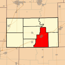 Location in Cumberland County | |
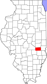 Cumberland County's location in Illinois | |
| Coordinates: 39°13′N 88°9′W / 39.217°N 88.150°WCoordinates: 39°13′N 88°9′W / 39.217°N 88.150°W | |
| Country |
|
| State |
|
| County | Cumberland |
| Established | November 6, 1860 |
| Area | |
| • Total | 47.47 sq mi (122.9 km2) |
| • Land | 47.43 sq mi (122.8 km2) |
| • Water | 0.03 sq mi (0.08 km2) 0.06% |
| Elevation | 594 ft (181 m) |
| Population (2010) | |
| • Estimate (2016)[1] | 2,374 |
| • Density | 50.9/sq mi (19.7/km2) |
| Time zone | UTC-6 (CST) |
| • Summer (DST) | UTC-5 (CDT) |
| ZIP codes | 62420, 62428, 62468 |
| FIPS code | 17-035-31537 |
Greenup Township is one of eight townships in Cumberland County, Illinois, USA. As of the 2010 census, its population was 2,413 and it contained 1,140 housing units.[2]
Geography
According to the 2010 census, the township has a total area of 47.47 square miles (122.9 km2), of which 47.43 square miles (122.8 km2) (or 99.92%) is land and 0.03 square miles (0.078 km2) (or 0.06%) is water.[2] The Embarras River defines a portion of the township's western border.
Cities, towns, villages
Unincorporated towns
Cemeteries
The township contains these seven cemeteries: Block, Boots, Greenup, Harmony, Liberty Hill, Paul and Peach Orchard.
Major highways
Demographics
| Historical population | |||
|---|---|---|---|
| Census | Pop. | %± | |
| Est. 2016 | 2,374 | [1] | |
| U.S. Decennial Census[3] | |||
School districts
- Casey-Westfield Community Unit School District 4c
- Cumberland Community Unit School District 77
- Jasper County Community Unit School District 1
Political districts
- State House District 109
- State Senate District 55
References
- "Greenup Township, Cumberland County, Illinois". Geographic Names Information System. United States Geological Survey. Retrieved 2010-01-17.
- United States Census Bureau 2009 TIGER/Line Shapefiles
- United States National Atlas
- 1 2 "Population and Housing Unit Estimates". Retrieved June 9, 2017.
- 1 2 "Population, Housing Units, Area, and Density: 2010 - County -- County Subdivision and Place -- 2010 Census Summary File 1". United States Census. Retrieved 2013-05-28.
- ↑ "Census of Population and Housing". Census.gov. Retrieved June 4, 2016.
External links
Adjacent townships
Places adjacent to Greenup Township, Cumberland County, Illinois | |
|---|---|
Municipalities and communities of Cumberland County, Illinois, United States | ||
|---|---|---|
| Cities | ||
| Villages | ||
| Townships | ||
| Unincorporated communities | ||
| Footnotes | ‡This populated place also has portions in an adjacent county or counties | |
This article is issued from
Wikipedia.
The text is licensed under Creative Commons - Attribution - Sharealike.
Additional terms may apply for the media files.