Greenfield Township, Orange County, Indiana
| Greenfield Township | |
|---|---|
| Township | |
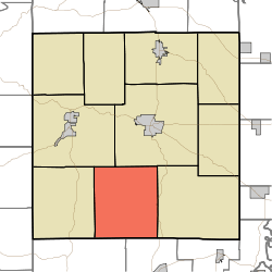 Location in Orange County | |
| Coordinates: 38°26′45″N 86°30′39″W / 38.44583°N 86.51083°WCoordinates: 38°26′45″N 86°30′39″W / 38.44583°N 86.51083°W | |
| Country |
|
| State |
|
| County | Orange |
| Government | |
| • Type | Indiana township |
| Area | |
| • Total | 43.14 sq mi (111.7 km2) |
| • Land | 41.22 sq mi (106.8 km2) |
| • Water | 1.92 sq mi (5.0 km2) 4.45% |
| Elevation | 673 ft (205 m) |
| Population (2010) | |
| • Total | 730 |
| • Density | 17.7/sq mi (6.8/km2) |
| Time zone | UTC-5 (Eastern (EST)) |
| • Summer (DST) | UTC-4 (EDT) |
| ZIP codes | 47118, 47140, 47175, 47432, 47454 |
| Area code(s) | 812, 930 |
| GNIS feature ID | 453352 |
Greenfield Township is one of ten townships in Orange County, Indiana, United States. As of the 2010 census, its population was 730 and it contained 530 housing units.[1]
Geography
According to the 2010 census, the township has a total area of 43.14 square miles (111.7 km2), of which 41.22 square miles (106.8 km2) (or 95.55%) is land and 1.92 square miles (5.0 km2) (or 4.45%) is water.[1]
Unincorporated towns
- Ethel at 38°24′13″N 86°31′28″W / 38.403669°N 86.524431°W
- Fargo at 38°24′00″N 86°29′00″W / 38.400058°N 86.483318°W
- Greenbrier at 38°27′47″N 86°33′21″W / 38.463112°N 86.555822°W
- Youngs Creek at 38°28′36″N 86°29′44″W / 38.476723°N 86.495543°W
(This list is based on USGS data and may include former settlements.)
Major highways
Lakes
- Tucker Lake
School districts
- Paoli Community School Corporation
Political districts
- Indiana's 9th congressional district
- State House District 62
- State Senate District 48
References
- "Greenfield Township, Orange County, Indiana". Geographic Names Information System. United States Geological Survey. Retrieved 2009-10-17.
- United States Census Bureau 2008 TIGER/Line Shapefiles
- IndianaMap
- 1 2 "Population, Housing Units, Area, and Density: 2010 - County -- County Subdivision and Place -- 2010 Census Summary File 1". United States Census. Retrieved 2013-05-10.
External links
- Indiana Township Association
- United Township Association of Indiana
- City-Data.com page for Greenfield Township
Places adjacent to Greenfield Township, Orange County, Indiana | |
|---|---|
Municipalities and communities of Orange County, Indiana, United States | ||
|---|---|---|
| Towns | ||
| Townships | ||
| Unincorporated communities |
| |
| Footnotes | ‡This populated place also has portions in an adjacent county or counties | |
This article is issued from
Wikipedia.
The text is licensed under Creative Commons - Attribution - Sharealike.
Additional terms may apply for the media files.