Green Fairfield
| Green Fairfield | |
|---|---|
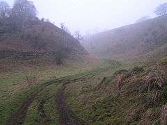 A misty morning, Woo Dale. | |
 Green Fairfield Green Fairfield shown within Derbyshire | |
| Population | 100 (2011)[1] |
| OS grid reference | SK090730 |
| District | |
| Shire county | |
| Region | |
| Country | England |
| Sovereign state | United Kingdom |
| Post town | BUXTON |
| Postcode district | SK17 |
| Police | Derbyshire |
| Fire | Derbyshire |
| Ambulance | East Midlands |
| EU Parliament | East Midlands |
Green Fairfield (Old English Green, beautiful open-land).[2] is a civil parish in Derbyshire, England. The population of the civil parish (including Tunstead) was 100. It is located in the Peak District, 4 miles west of Buxton and north of the parish of King Sterndale. Woo Dale lies within the parish.[3]
References
- ↑ "ONS Neighbourhood Statistics Green Fairfield". Retrieved 8 January 2015.
- ↑ "Green Fairfield". Key to English Place Names. Institute for Name Studies, University of Nottingham. Retrieved 12 May 2011.
- ↑ Peak District Online accessed 16 Feb 2011
This article is issued from
Wikipedia.
The text is licensed under Creative Commons - Attribution - Sharealike.
Additional terms may apply for the media files.