Great Island
| Native name: An tOileán Mór | |
|---|---|
 Cobh is the largest town on Great Island | |
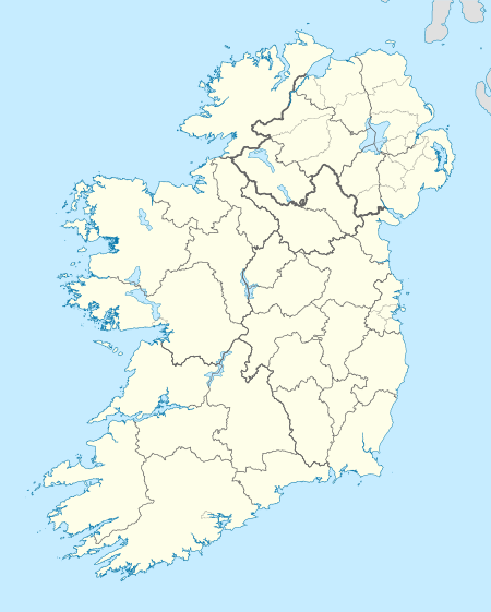 Great Island Location in Ireland | |
| Geography | |
| Location | Cork Harbour |
| Coordinates | 51°51′57″N 08°16′02″W / 51.86583°N 8.26722°WCoordinates: 51°51′57″N 08°16′02″W / 51.86583°N 8.26722°W |
| Length | 8 km (5 mi) east>west (approx) |
| Width | 4 km (2.5 mi) north>sth (approx) |
| Administration | |
| County | County Cork |
| Demographics | |
| Population | 12,000–14,000[1][2] |
Great Island (Irish: An tOileán Mór)[3] is an island in Cork Harbour, at the mouth of the River Lee in Ireland. The largest town on the island is Cobh, and the island's economic and social history has historically been linked to the naval, ship-building, and shipping activities in the town's environs.[4] Located close to Cork city, as of the 21st century, a key economic driver is tourism – including the cruise tourism attracted by the Port of Cork berthing facilities on the island.[5][6]
History
The ancient name of the island was Oilean Ard na Neimheadh, the "High (or important) island of Neimheadh".[7] Neimheadh was, according to the 11th century Lebor Gabála Érenn, the leader of a group who invaded the area in prehistoric times.[8] Archaeological evidence of prehistoric and early medieval settlement on Great Island is recorded on the Record of Monuments and Places of the National Monuments Service.[9] This includes records of ringfort, fulacht fiadh, holy well and bee bole structures.[10][11]
.jpg)
By the early 13th century, the island was under the control of the Anglo-Norman Hodnett family.[12][7] The Hodnetts built several structures, including Belvelly Castle, to defend the island and its approaches.[12] The island and its defenses were taken by the de Barra (Barry) family in the 14th century.[13] The Barry family (later Earls of Barrymore) retained power in the area for several centuries, and the island became known as Oileán Mór an Barraigh, meaning "Great island of the Barrys".[7]
In the 18th and 19th centuries, due to the strategic importance of the island within Cork Harbour (overlooking the naval berths and military bases at Haulbowline and Spike Island), several coastal defence fortifications were built on Great Island. These included the construction of Cove Fort (between Cobh and Cuskinny) in the 18th century and several Martello towers (at Belvelly, Monning and Rossleague) in the 19th century.[14]
The largest settlement on Great Island, Cobh, saw significant development during the 19th century and early 20th century, coinciding with additional expansion in shipping and naval activity in the area.[15]
Location and access
.jpg)
Great Island is located in Cork Harbour on Ireland's south coast, and is made-up of the civil parishes of 'Clonmel' and 'Templerobin'.[16][17]
The island is connected by road bridge to Fota Island to the north – which, in turn, connects via a causeway to the mainland. This road bridge, Belvelly Bridge, was built in 1803 at one of the narrowest points in the channels around Great Island.[18] At more than 200 years old, it is the only road bridge to the island.[19]
A railway bridge and rail line also runs out through Fota Island to Great Island. Railway stations on Great Island include Carrigaloe station and Rushbrooke station, and the terminus at Cobh. A ferry service also connects the island (from a point near Carrigaloe) to the mainland (at a point near Passage West).[20][21]
During regional windstorms in 2017 (including ex-hurricane Ophelia), downed trees and high winds resulted in the closure of the only road bridge to Great Island, as well as the cancellation of ferry and rail services, leaving 12,000 residents "stranded".[1][22] This led to some calls for a review of emergency access provisions and plans for the island.[19]
Land use and economy
In the 19th century Topographical Dictionary of Ireland (published by Samuel Lewis in 1837), Great Island is described as "very fertile" with its "light productive soil" supporting agricultural uses with "two-thirds [of the island] under tillage, and the remainder in pasture or included in demesnes".[7] Lewis also describes the island's location, environment and climate as factors "induc[ing] many genteel families to settle here".[7]
As of the 21st century, land use on Great Island remains primarily agricultural and residential in nature, and the island has a population of between 12,000 and 14,000.[1][2] While some of this population work on the island, as of the early 21st century, an increasing percentage of the island's residents fall within the commuter area for Cork city, and connect via road, Cork Commuter Rail and bus services to Cork.[6][23] Residential developments are mainly concentrated around Cobh, with other populated townlands and settlements on the island including Ballymore, Ballynoe, and Belvelly.[16][17]
Prior to the 21st century, land use included industrial zones, such as the former Irish Fertilizer Industries plant at Marino Point,[24] and the Verolme Cork Dockyard at Rushbrooke.[25] The latter was involved in the construction of vessels for the Irish Naval Service, such as the LÉ Eithne. Many of these heavy industries have since closed,[25][26] though some smaller boatbuilding companies are still based at Cobh.[27]
Tourism is now an economic driver on this island,[6] and Great Island is the location of Ireland's only dedicated berth for visiting cruise ships.[28]
Ecology

There are several proposed conservation sites and green areas on and around the island. These include Cuskinny Marsh Nature Reserve (which is managed by BirdWatch Ireland),[29] Marlogue Wood (operated by Coillte),[30] and the Great Island Channel Special Area of Conservation (overseen by the National Parks and Wildlife Service).[31] The latter, the Great Island Special Area of Conservation, proposes conservation controls (including aquaculture limits) to protect the animal and bird habitats of the area's salt marshes.[32] While larger fish species are less common in the Great Island Special Area of Conservation, a large blue shark was recorded just off the island in mid-2018.[33]
See also
References
- 1 2 3 "Clean-up to centre on Cobh after 12,000 left stranded". irishexaminer.com. Irish Examiner. 17 October 2017. Retrieved 4 August 2018.
- 1 2 The island comprises two electoral districts: Cobh Urban (which had a population of 6,525 in the 2016 census) and Cobh Rural (8,353)
- ↑ "An tOileán Mór". logainm.ie. Placenames Database of Ireland. Retrieved 1 August 2018.
- ↑ "Cobh Town Development Plan 2013 – Volume 1: Main Policy Material" (PDF). Planning Policy Documents. Cork County Council. 2013. Retrieved 4 August 2018.
the past [and] future economic prosperity of Cobh is intrinsically linked with the harbour and facilities for ship access
- ↑ "Cork set for €15 million tourism boost this summer as cruise liner grows". irishtimes.com. Irish Times. 24 March 2018. Retrieved 2 August 2018.
- 1 2 3 "Future of this town has to be in tourism". irishexaminer.com. Irish Examiner. 7 December 2011. Retrieved 2 August 2018.
- 1 2 3 4 5 Samuel Lewis (1837). Lewis: A Topographical Dictionary of Ireland – Volume 1. London: Lewis – via Libraryireland.com.
- ↑ Geoffrey Keating (1723). The History of Ireland. University College Cork. Retrieved 1 August 2018 – via CELT: The Corpus of Electronic Texts.
- ↑ "Recorded Monuments Protected under Section 12 of the National Monuments (Amendment) Act – County Cork" (PDF). archaeology.ie. Department of The Environment, Heritage and Local Government. 1998.
- ↑ "Cuskinny Marsh Nature Reserve – Archaeology". cuskinnynaturereserve.com. BWI. Retrieved 2 August 2018.
- ↑ "Cultural Heritage Assessment of proposed works on outfalls at Cobh – Report" (PDF). Irish Water. Nicholas O’Dwyer Consulting Engineers. June 2016. Retrieved 2 August 2018.
- 1 2 Nathaniel Parker Willis; Joseph Stirling Coyne (1842). The Scenery and Antiquities of Ireland (volume 2). George Virtue.
- ↑ Tom Barry. "Where the Rock of Tuathail towers o'er each breast – A Short History of Carrigtwohill". Archived from the original on 13 September 2013. Retrieved 26 May 2014.
- ↑ "Notes and queries: The Martello towers of Cork harbour". Journal of the Cork Historical and Archaeological Society: 200. 1907.
- ↑ Henry Edward Dennehy (1990). History of Great Island : the cove of Cork, and Queenstown. Tower Books.
- 1 2 "Civil Parish of Clonmel, Co. Cork". Townlands.ie. Irish Townlands. Retrieved 2 August 2018.
- 1 2 "Civil Parish of Templerobin, Co. Cork". Townlands.ie. Irish Townlands. Retrieved 2 August 2018.
- ↑ "Belvelly Bridge, County Cork". buildingsofireland.ie. National Inventory of Architectural Heritage. Retrieved 2 August 2018.
- 1 2 "Calls for 'island designation' campaign for Cobh after Ophelia". irishexaminer.com. Irish Examiner. 18 October 2017. Retrieved 2 August 2018.
the only bridge leading into Great Island, at Belvelly [Bridge], is 200 years old
- ↑ "Cross River Ferries – About". crossriverferries.ie. Doyle Shipping Group. Retrieved 2 August 2018.
- ↑ "Cross River Ferries". irish-ferries-enthusiasts.com. Retrieved 1 August 2018.
In 1993 Cork County Council and the newly formed Cross River Ferries Ltd [..] started a lower river crossing, linking Carrigaloe, on Great Island with Glenbrook [Passage West/Monkstown] on the opposite side
- ↑ "Trees face the chop in order to keep Cobh open". irishexaminer.com. Irish Examiner. 11 January 2018. Retrieved 2 August 2018.
council officials have sent warning notices to landowners along the Fota Rd, the sole route which connects the 11,000 inhabitants of Cobh and Great Island with mainland Cork. Following Storm Ophelia, residents in the area were cut off [by] road while train services and the cross-river ferry had been cancelled for safety reasons
- ↑ "New Bus service links Cobh with Cork City". thecork.ie. TheCork.ie. 30 October 2017. Retrieved 2 August 2018.
[Cobh is] Cork’s largest commuter town
- ↑ "A study of land-use change and present habitats at Marino Point – a coastal brownfield site in Cork Harbour" (PDF). Coastal and Marine Research Centre. University College Cork. 2005. Retrieved 2 August 2018.
- 1 2 "Gathering of Verolme Workers Commemorate 160 Years of Cork Shipbuilding". afloat.ie. Afloat Magazine. 26 August 2013. Retrieved 2 August 2018.
- ↑ "Cobh boosted by purchase of former IFI site at Marino Point". irishexaminer.com. Irish Examiner. 28 July 2016. Retrieved 2 August 2018.
- ↑ "Irish Boatbuilder Safehaven Set to Launch New UK Royal Navy Vessel". afloat.ie. Afloat Magazine. 7 February 2018. Retrieved 2 August 2018.
- ↑ "Port of Cork cruising towards €15m terminal". irishexaminer.com. Irish Examiner. 27 July 2017. Retrieved 4 August 2018.
The Port of Cork currently boasts the only dedicated cruise ship berth in Ireland — in Cobh [on Great Island]
- ↑ "Cuskinny Marsh Nature Reserve". cuskinnynaturereserve.com. BWI. Retrieved 2 August 2018.
- ↑ "Marlogue Woods". coillte.ie. Coillte. Retrieved 2 August 2018.
- ↑ "Great Island Channel SAC (site code 1058) Conservation objectives – Report" (PDF). npws.ie. National Parks and Wildlife Service. May 2014. Retrieved 2 August 2018.
- ↑ "Assessment of the Conservation Status of the Great Island Channel SAC" (PDF). Cork County Council Development Plan. Cork County Council. June 2014. Retrieved 2 August 2018.
- ↑ "Co Cork postman delivers shark to safety". Irish Examiner. 18 July 2018. Retrieved 2 August 2018.